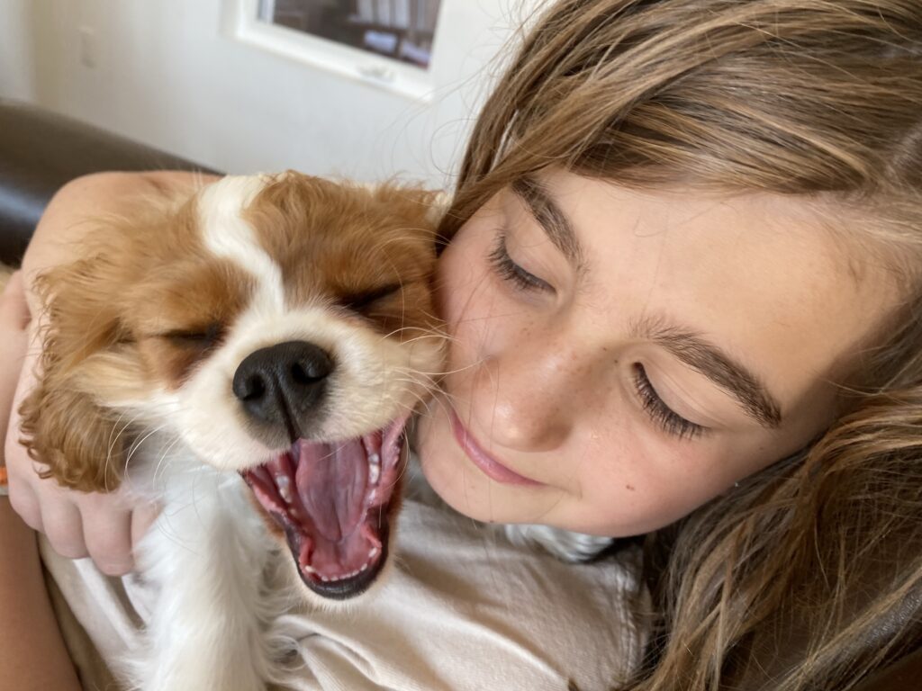
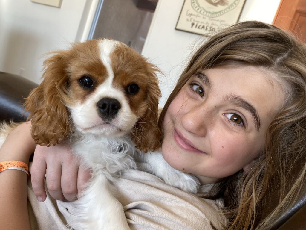
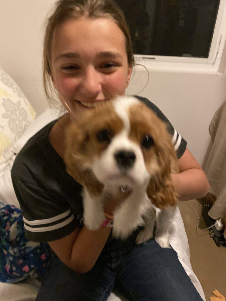
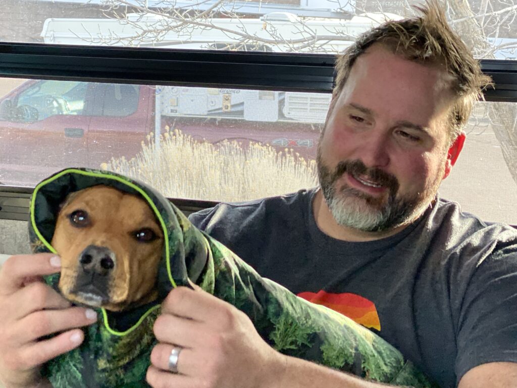
Dexter is just too cute and we are so lucky to be around a puppy as a bonus to our family visit. A few hours in the morning was easily spent cuddling.
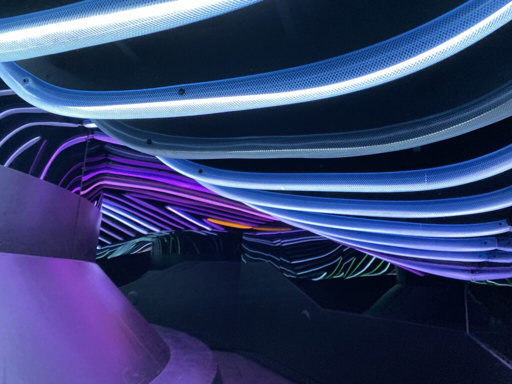
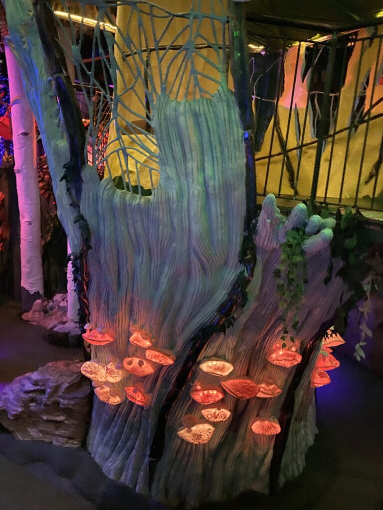
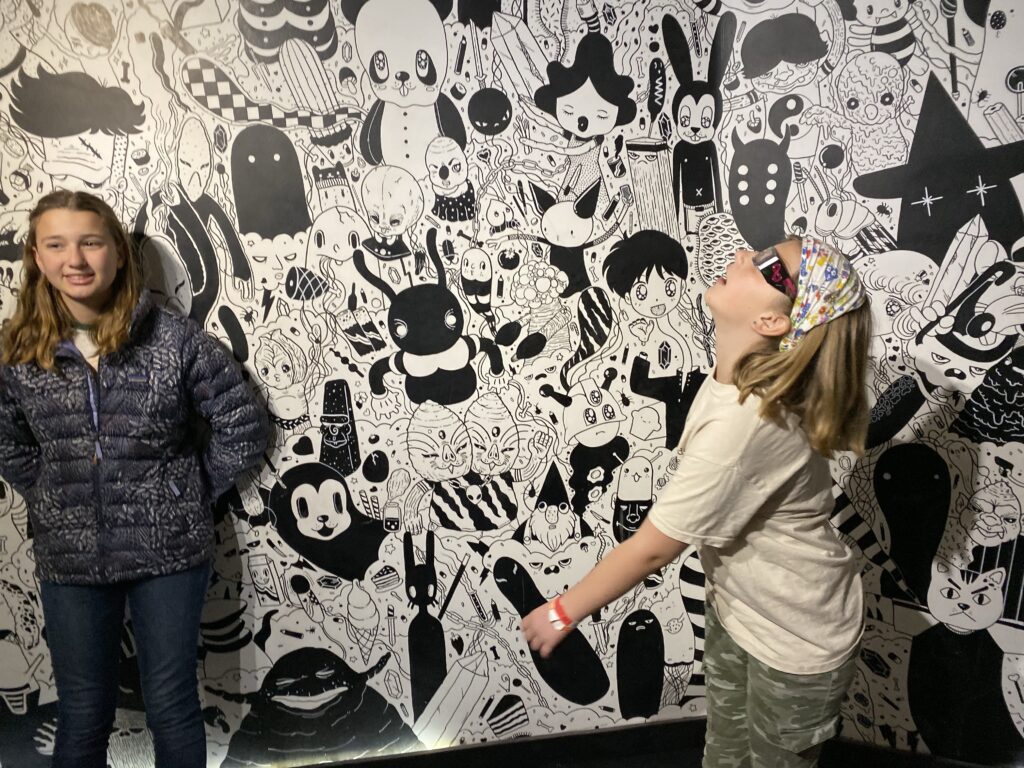
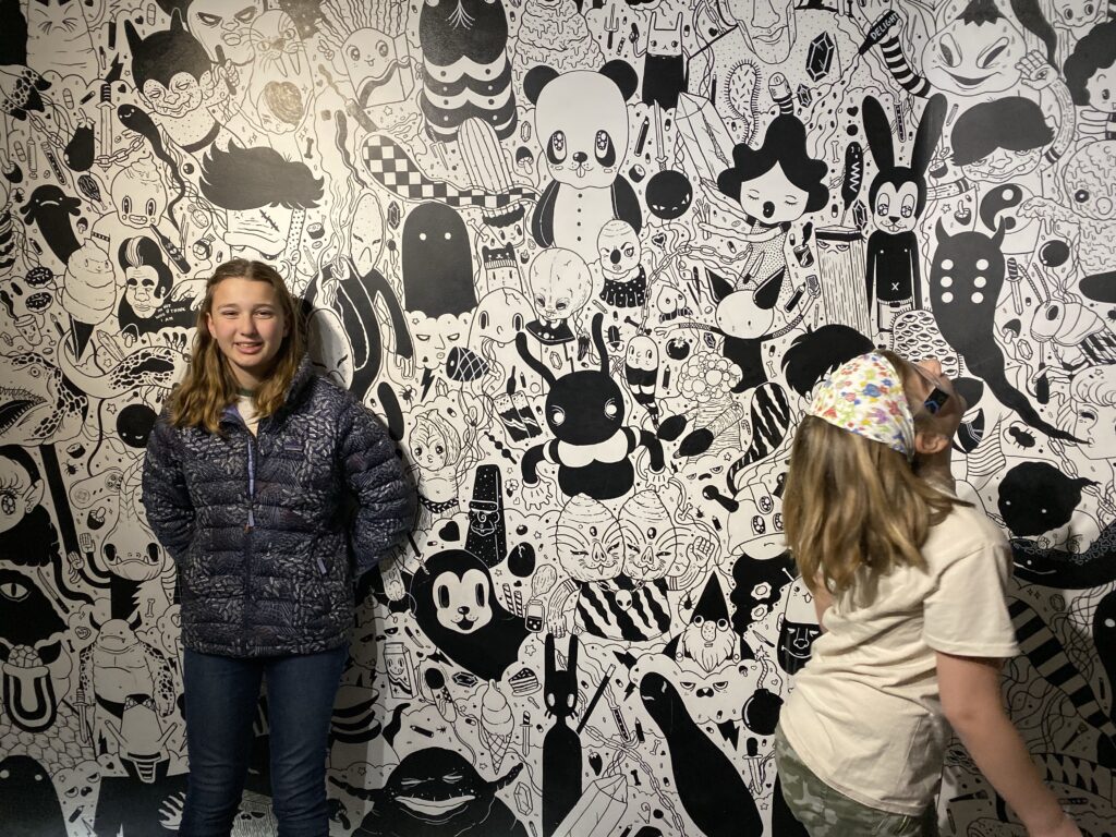
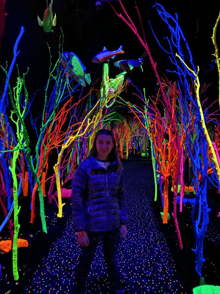
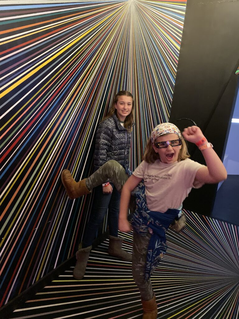
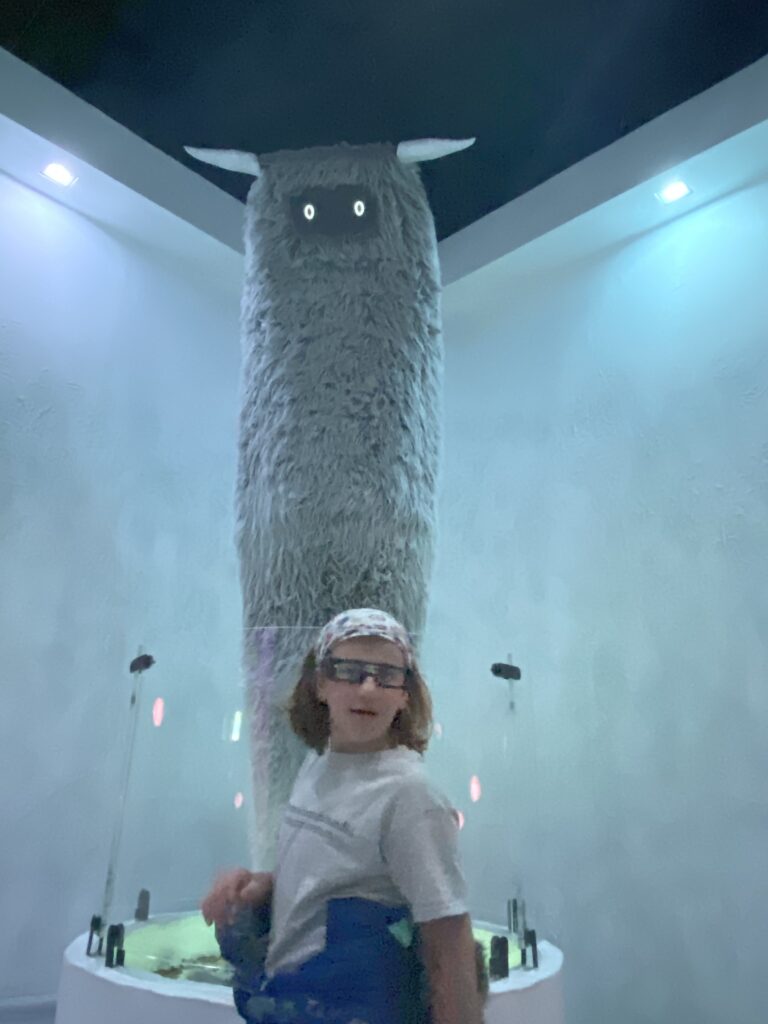
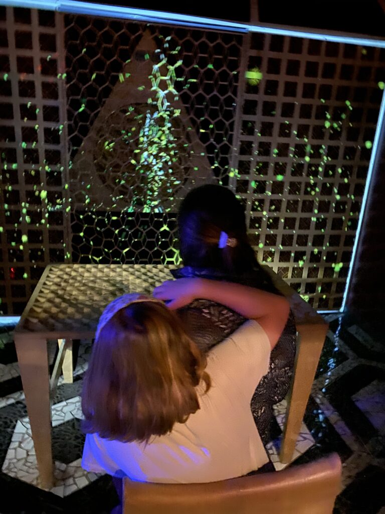
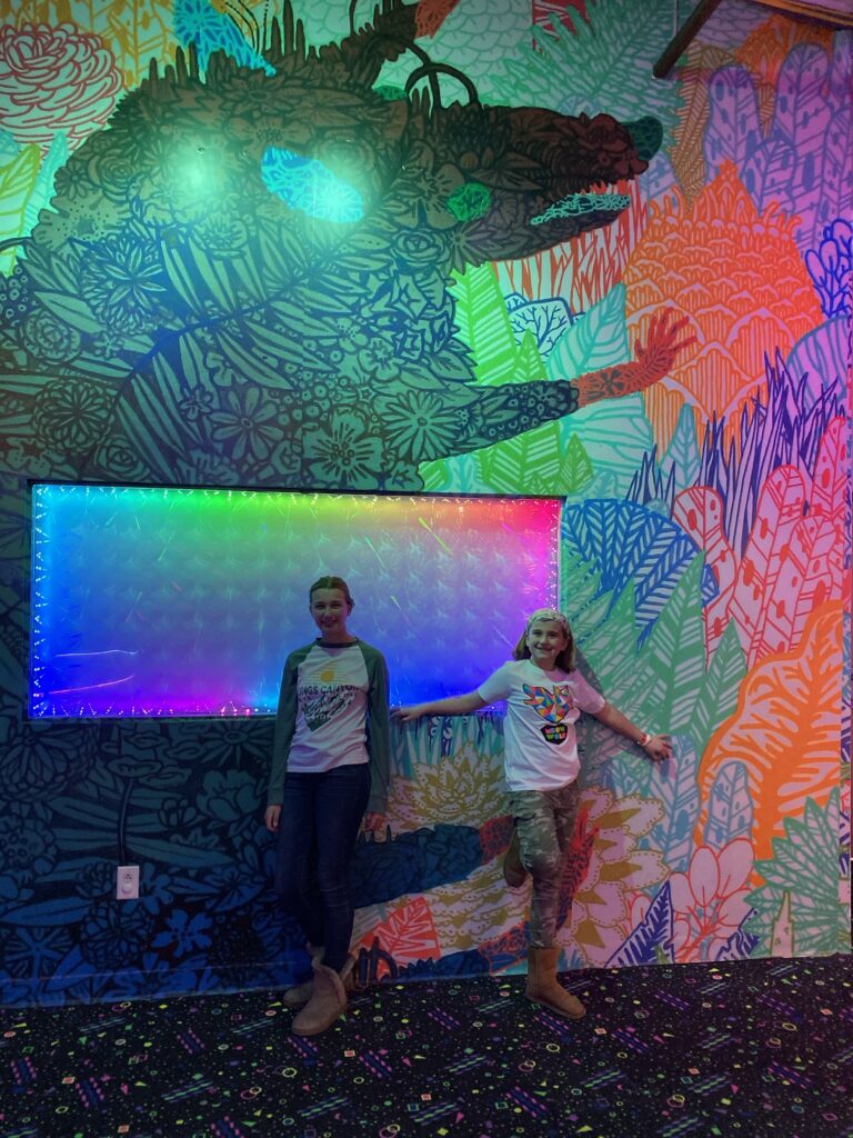
Meow Wolf was our program for the day. Hard to explain Meow Wolf…it’s an interactive art installation of a house with alternate worlds along mystery to solve if you choose.
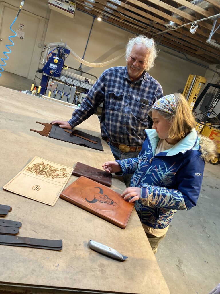
After a few hours when our eyes started hurting we had a late lunch and went to Cia’s other job at the Santa Fe maker space. G showed us his leather work and using the plasma cutter.
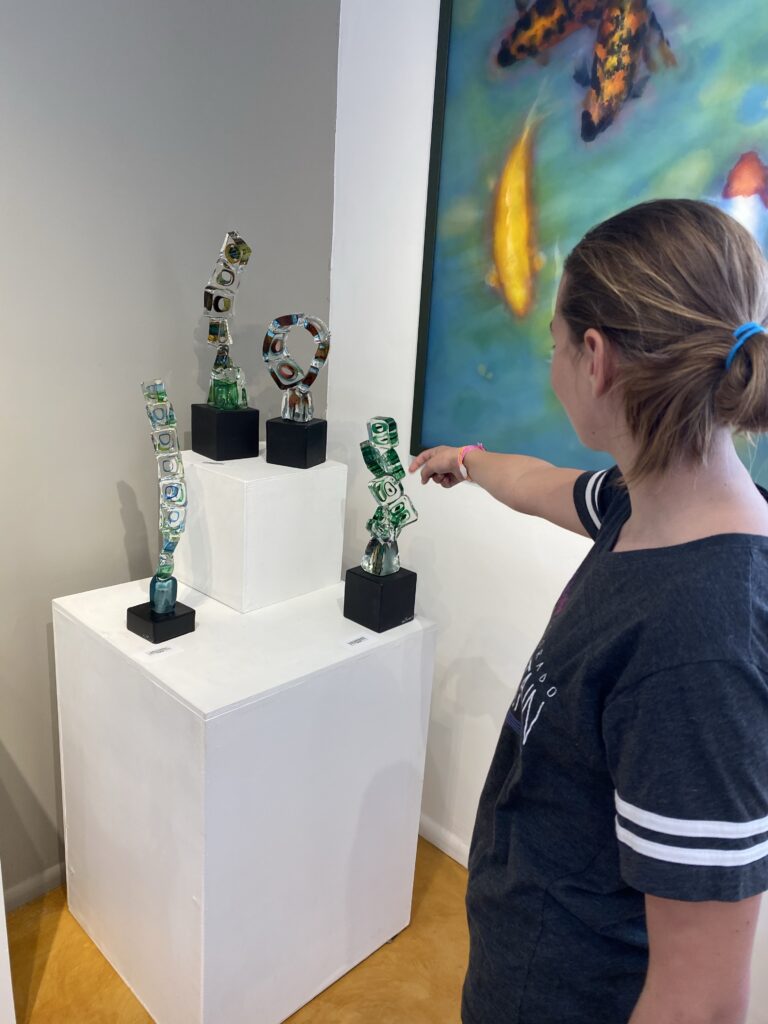
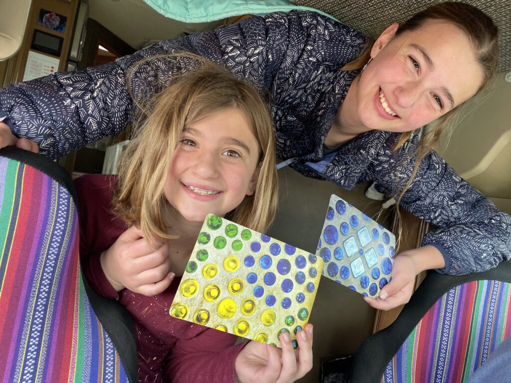
Over to Liquid Light to pick up the paperweights we made. The shells below are some Cia’s other work.
We went back to Meow Wolf for another few hours to find some other portals we missed.
Circling back to 1st Avenue and college…Ani DiFranco was playing at Meow Wold tonight’s
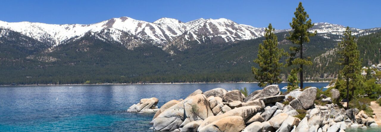
It snowed last night in Santa Fe…which it does about 5x a year. We seem to be following snow and cold weather wherever we go. The positive side is that the kids had a snow day so we got to play.
Morning hugs Lunch is better with a friend
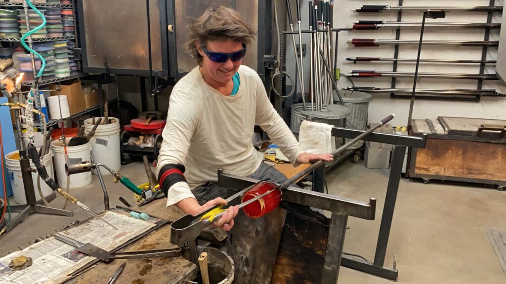
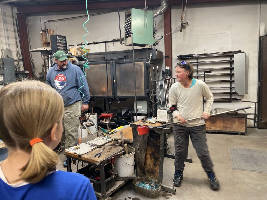
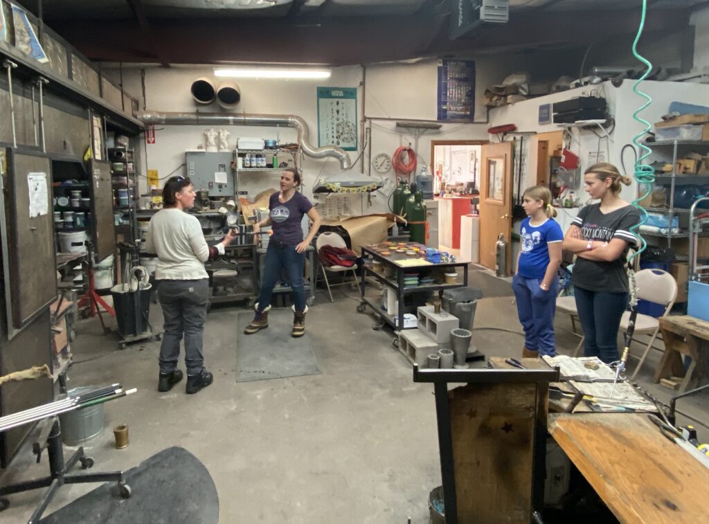
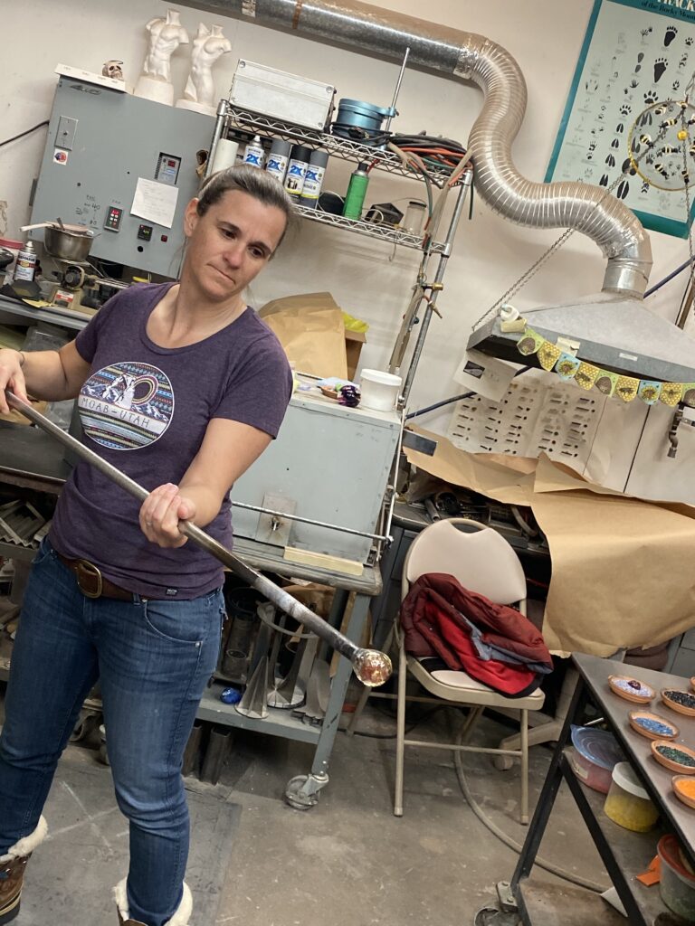
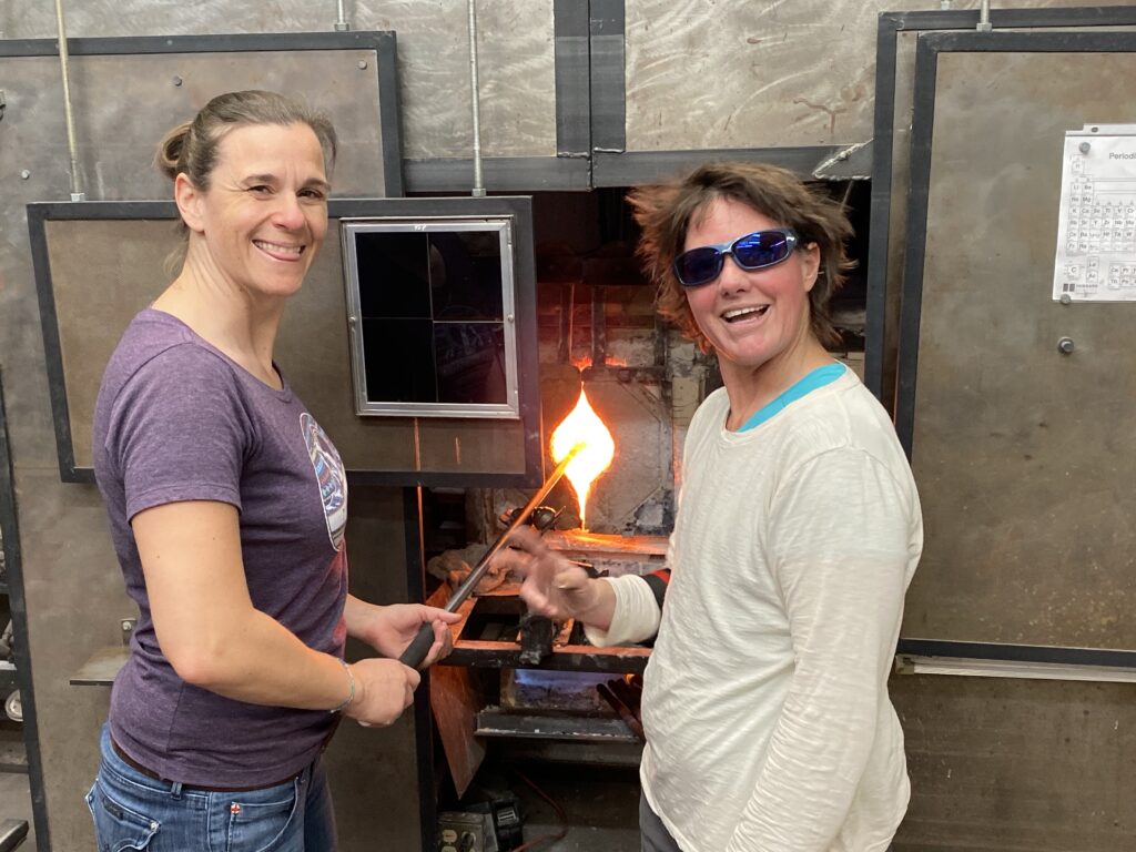
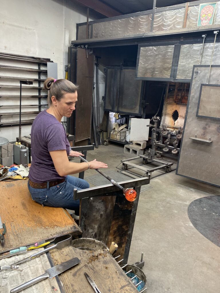
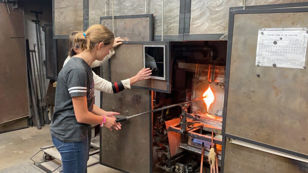
We had a very exciting afternoon…something we’ve been looking forward to this whole trip. Edwins sister Cia is a glass blower and we got to go to the studio and make some paper weights. It was so much fun.
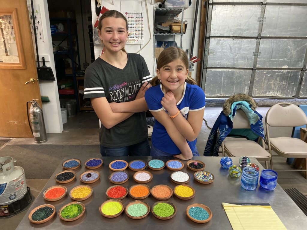
Cia was working on a project when we walked inSo excited and so many colors to choose fromSome of Cia’s artwork
Kati’s turn
Isabella’s turn
Vera’s turn
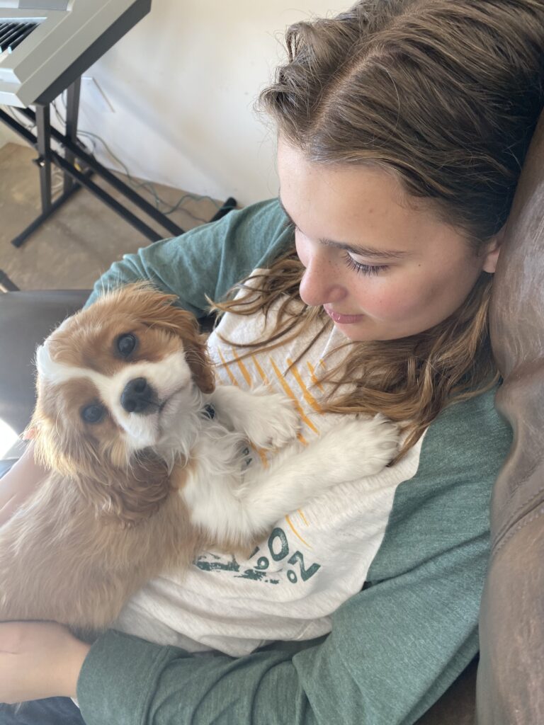
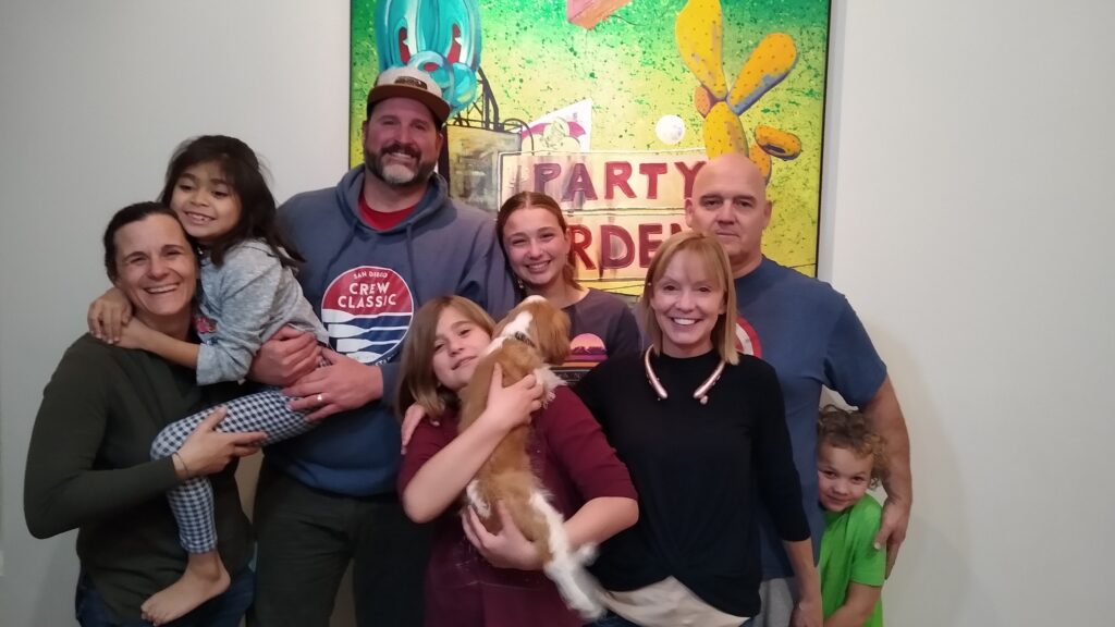
That was a lot of fun Cia, thank you!!! We went back to T.C.’s and got some solid Dexter time along with the cousins.
And we left Colorado to drive south to Santa Fe, New Mexico where Edwin’s 2 sisters live.
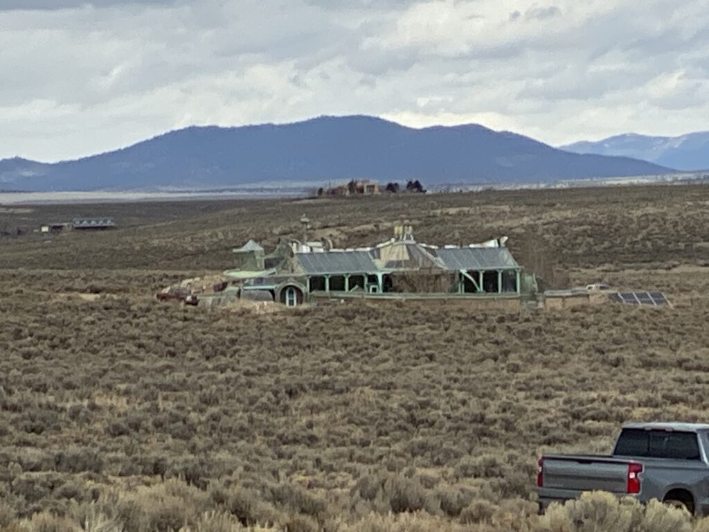
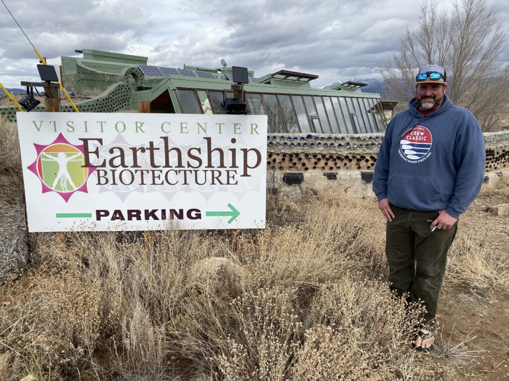
One of the employees from the hot springs last night was telling us about how she moved out from California and built and is living in an Earthship where she lives completely off the grid. She told us about a large community outside Taos and we should check them out. We were planning on driving through Taos anyway on the way to Santa Fe because Edwin’s parents were married in Taos.
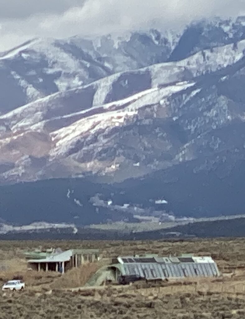
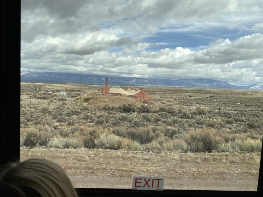
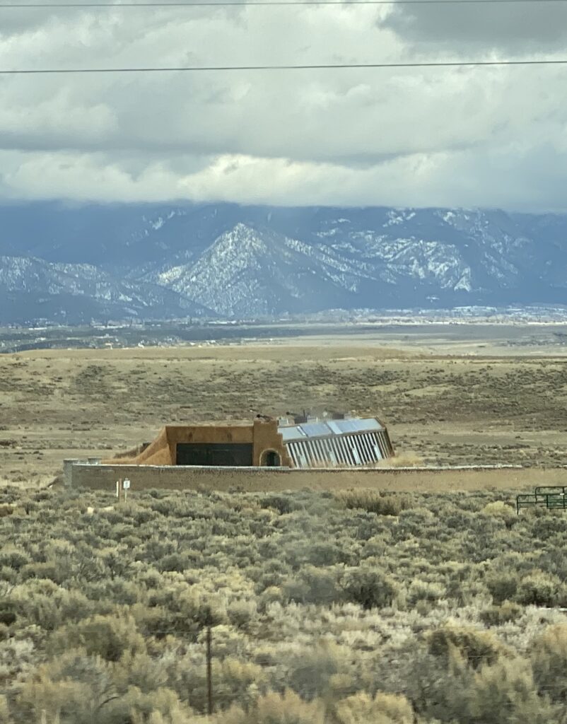
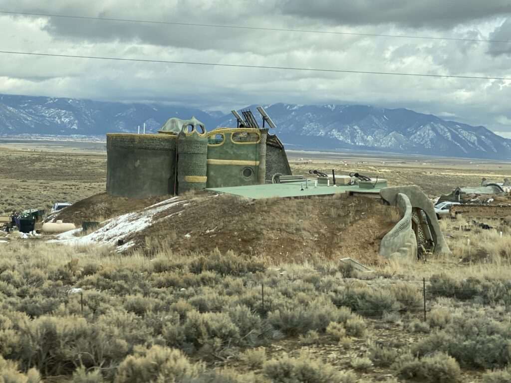
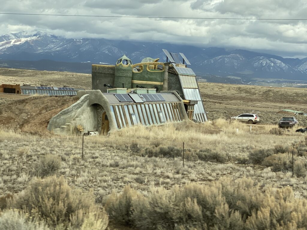
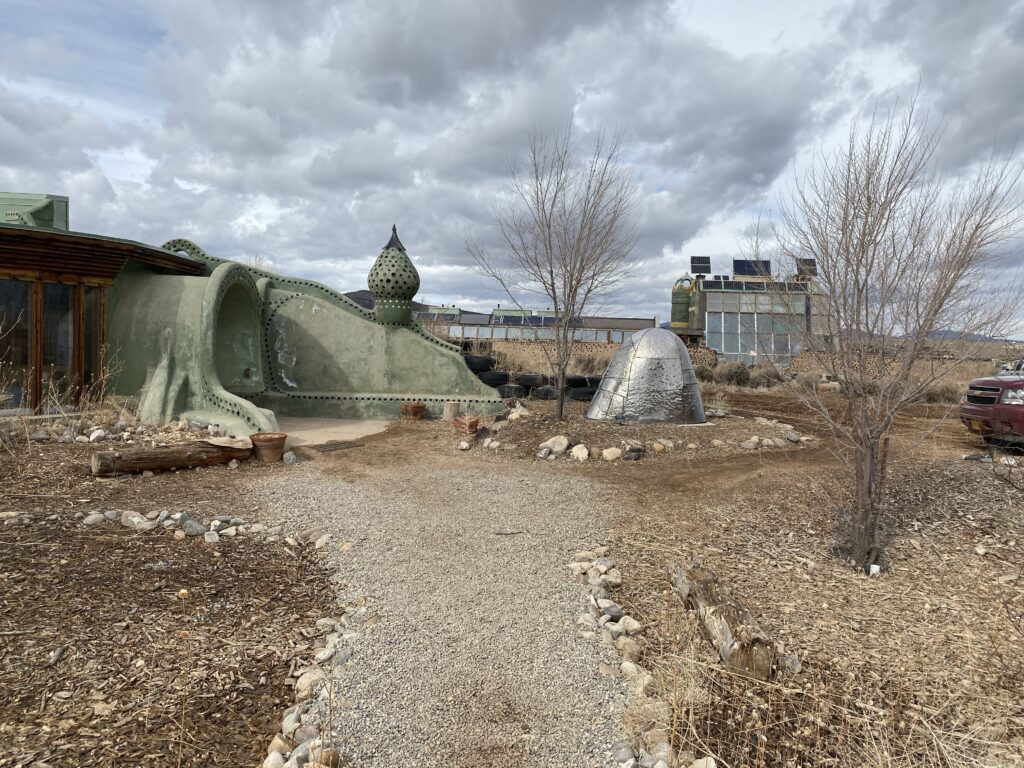
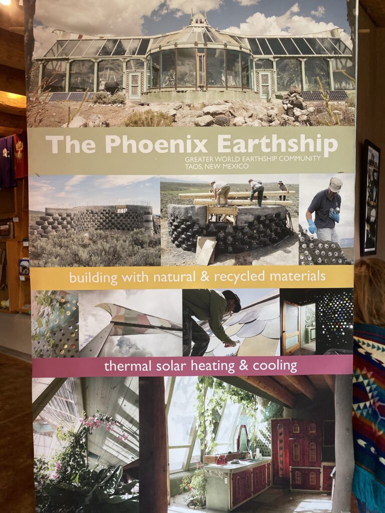
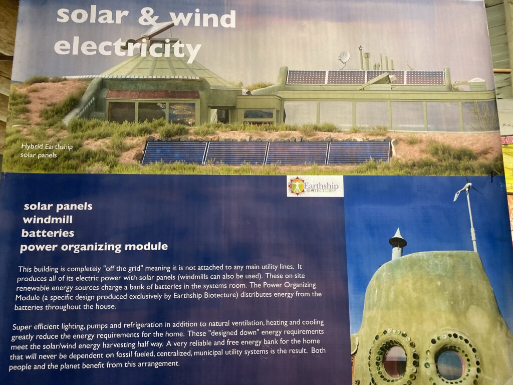
We stopped by the earthships.
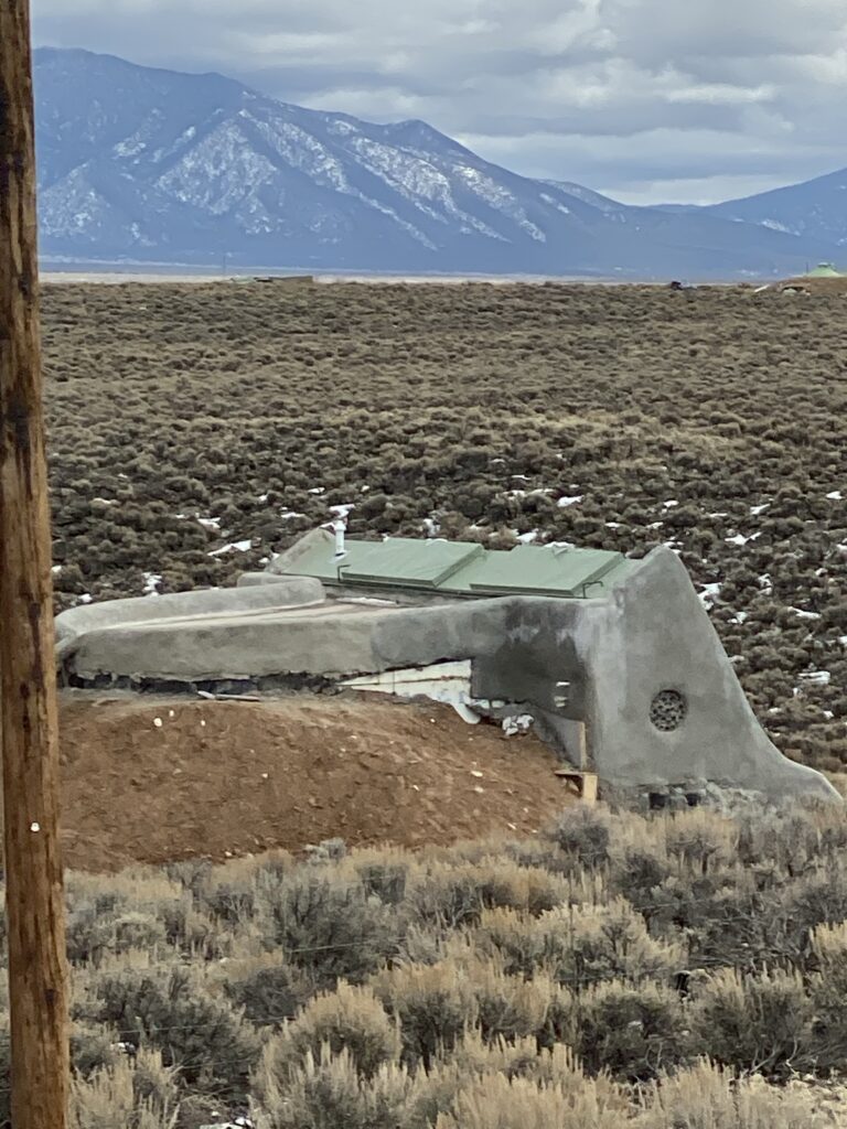
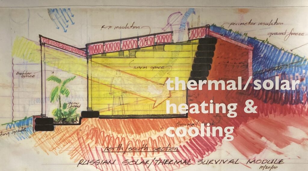
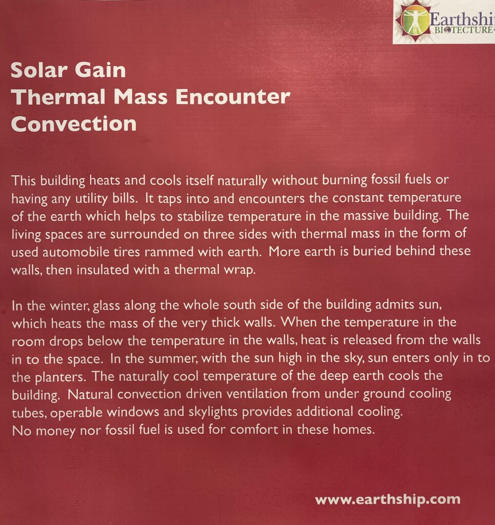
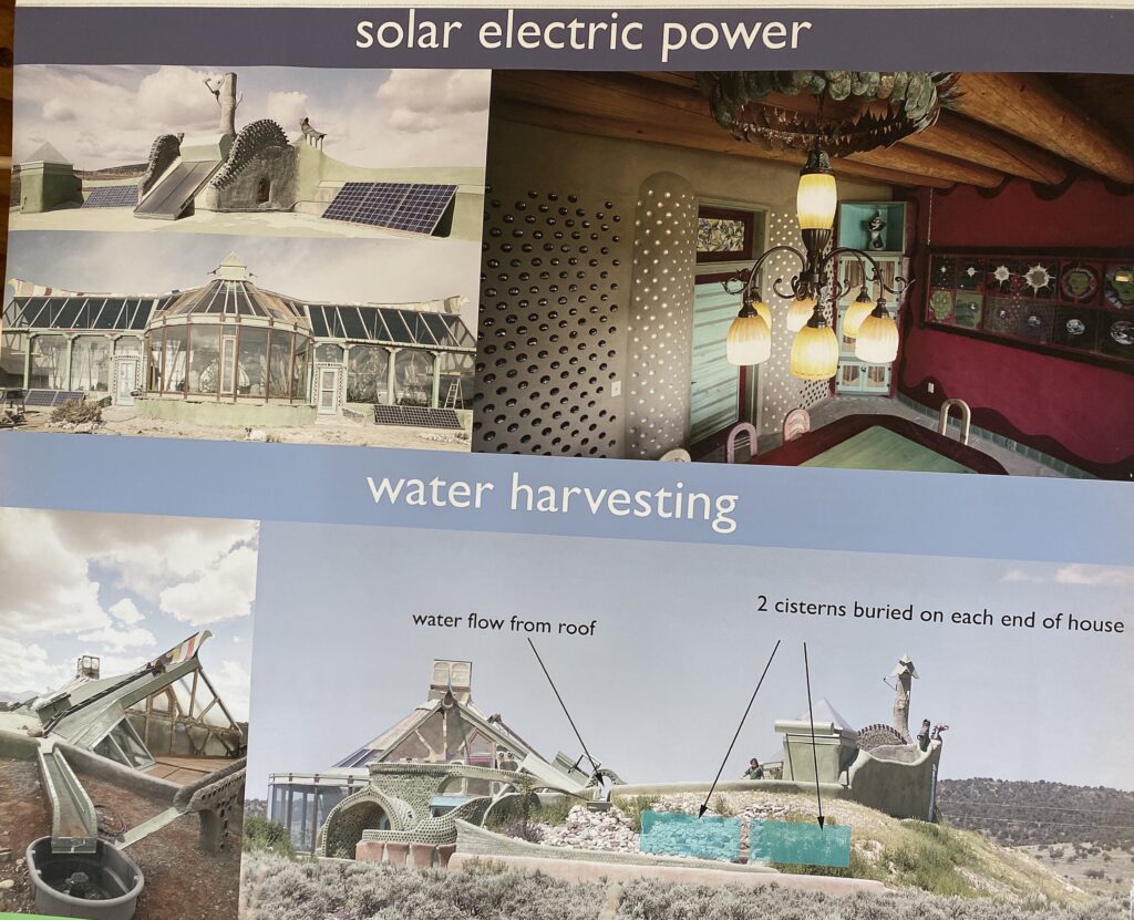
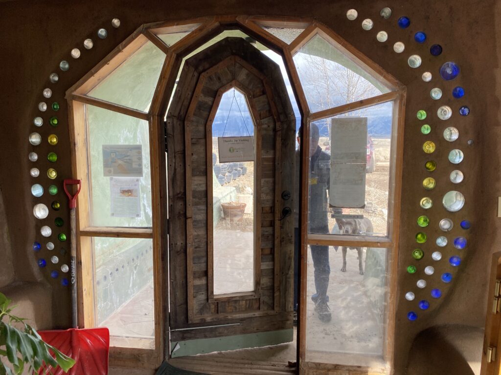
So what exactly is an earthship? Earthships are “off the grid” homes. They are built with 3 sides of the home covered in dirt to provide thermal mass. The construction of the dirt walls are often built with rubber tires filled with dirt. The tires and dirt absorb the solar heat from the day and radiate the heat back into the home during the night and provides temperature regulation.
Most homes are covered in solar panels and/or wind turbines to store the energy in batteries. Earthships are designed to collect and store their own power. They are not plugged into the public utilities.
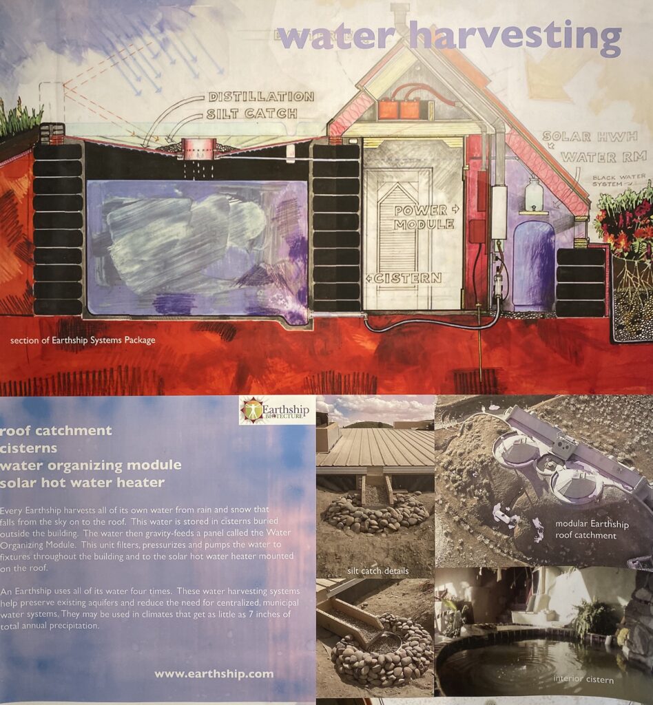
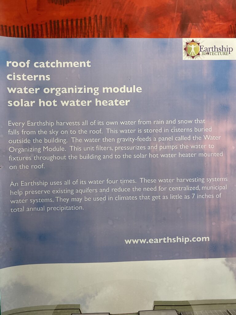
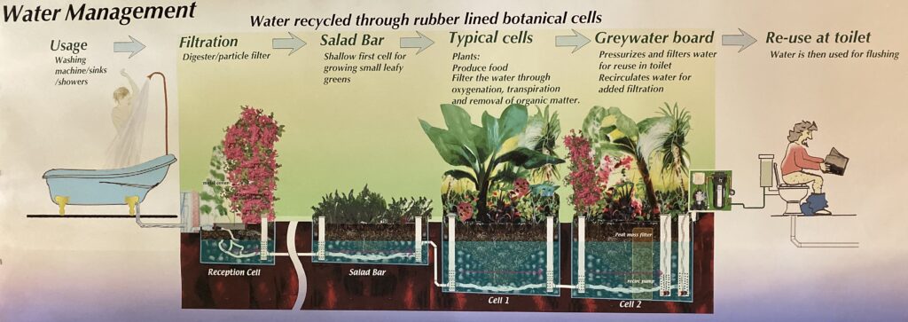
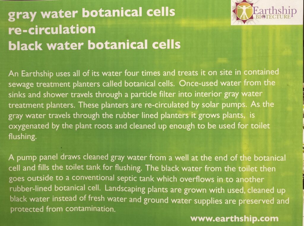
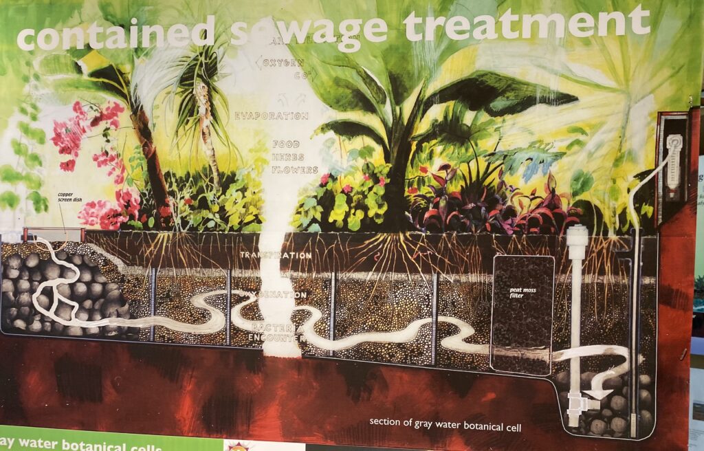
So what about water? Earthships are designed to catch all the water they need from the local environment. They catch rain water and store in 4-8 1500 gallon cisterns that are buried underground next to the home.
And how do you make the water last? Well it’s designed to be used 4 times. 1)Water is used for drinking, showers, washing hands etc… 2)The water is then recycled and through gravity is led through the home where it provides water for the plants and vegetables inside the home. 3)Then the water is recycled and used for toilet flushing. 4)Water is then used for outside landscaping and growing things that are not leafy greens or food with large root systems.
For the 2nd cycle the water is used to grow a vegetable garden inside the home or plants for carbon dioxide/oxygen exchange.
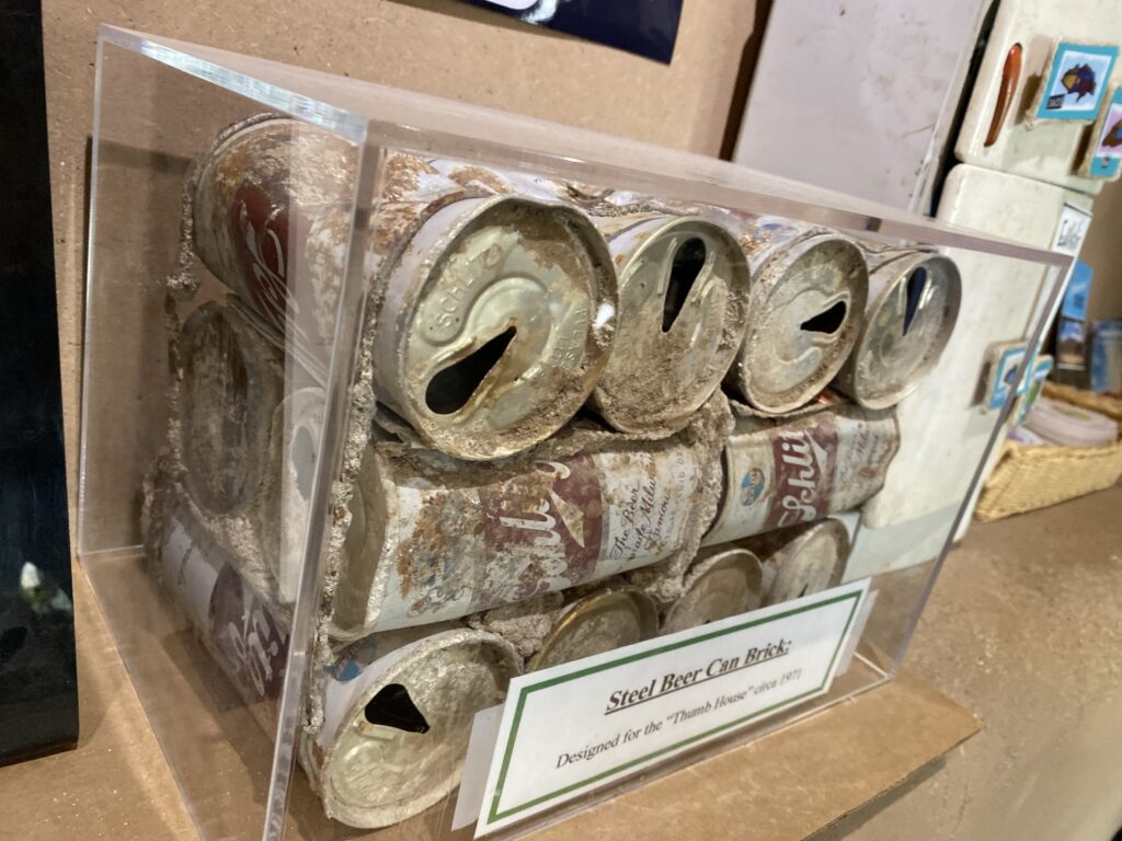
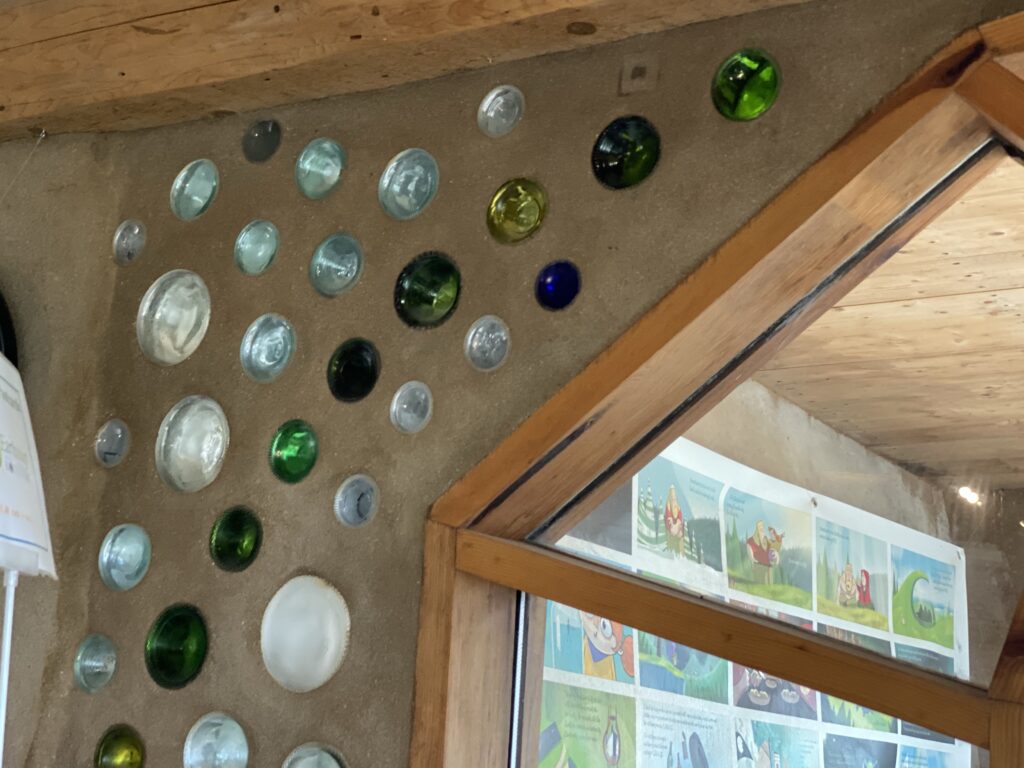
Earthships are also designed for low cost building as well as using recycled materials. Tires are in abundance everywhere including 3rd world countries. So are other materials like bottles, aluminum cans or plastic garbage. These materials are used in building to provide structure, be a low cost for those in poor environments, and to use up resources that would otherwise be landfill. Aluminum cans from below can be built into a “brick block”. You can also collect plastic bottles, fill them with plastic garbage.
Glass bottles are used 2 fold. For aesthetic purposes…mimicking stained glass windows. It also brings in sunlight and warmth to the home.
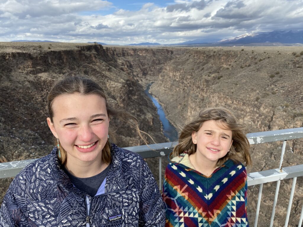
On the way to Taos we drove over the San Juan River and over the Rio Grande Gorge. At 600’ above the gorge it’s the 10th highest bridge in the U.S.
We had an amazing lunch and beer at the Burger Stand. And went by the 1at Presbyterian Church where Nana got married.
The Pueblo in town was closed for tribal obligations.
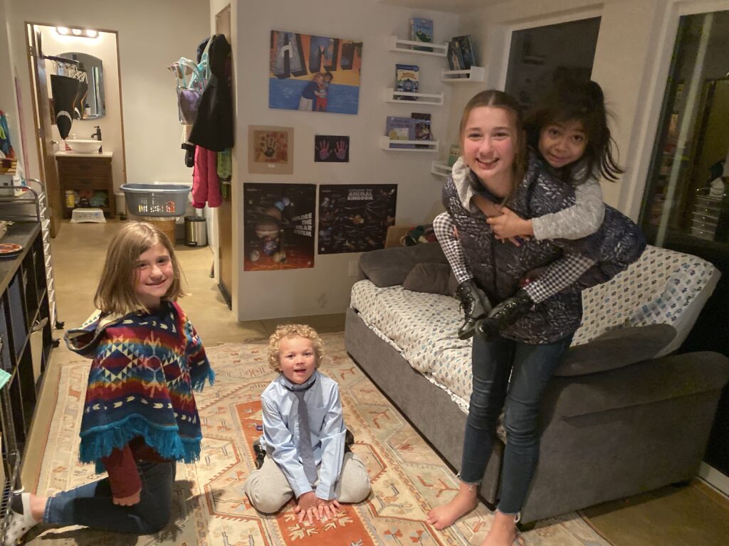
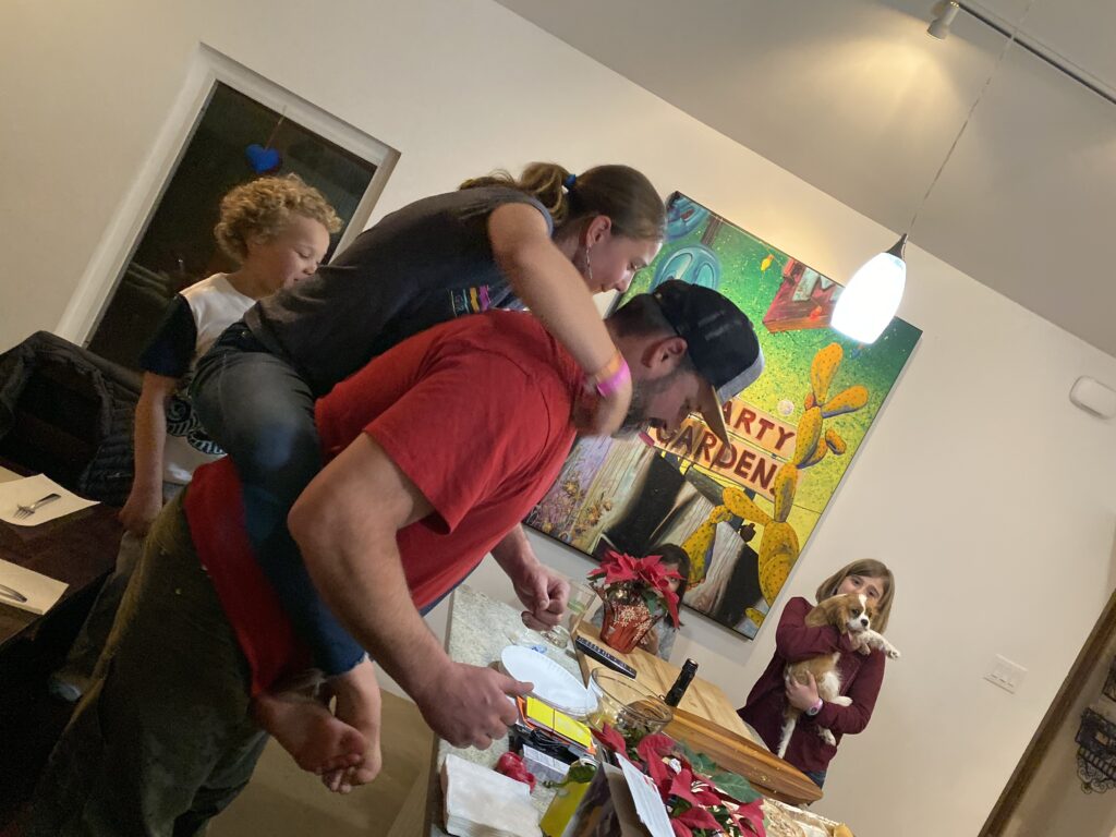
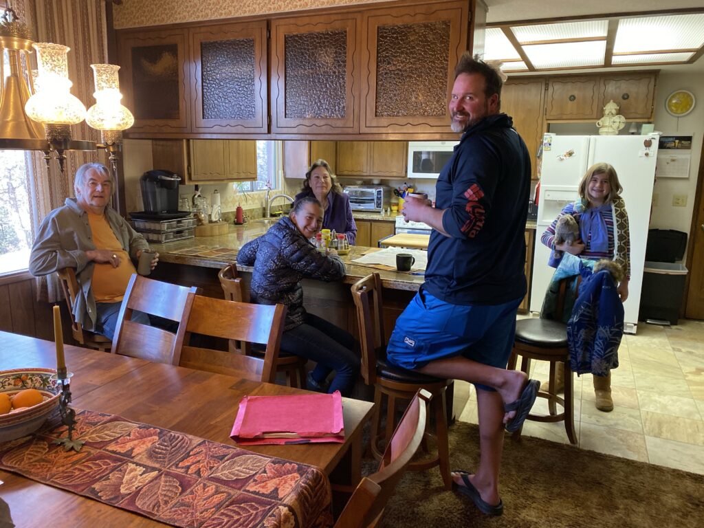
So off to Santa Fe. The kids were excited to meet cousins on Edwin’s side for the first time.
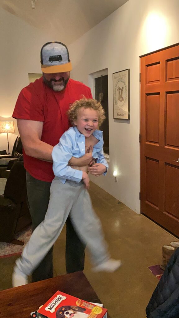
Who doesn’t like to fly with uncle Edwin??
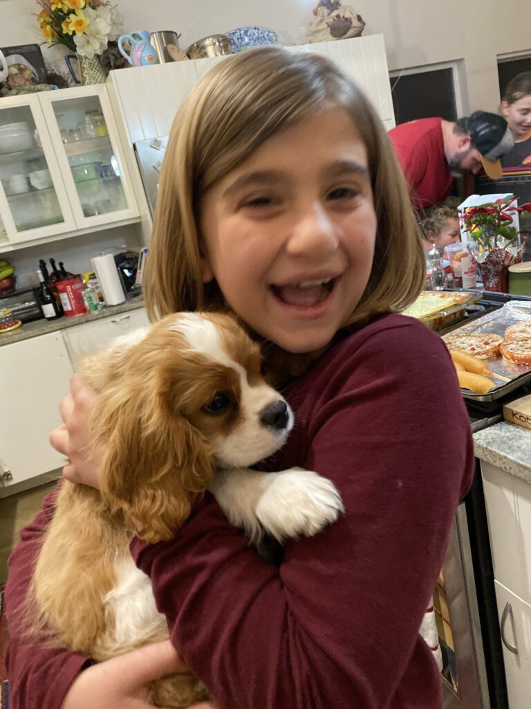
So excited to snuggle with a 3 month old puppy, Dexter
Edwin with his sisters , Cia (left), TC (right), with TC’s kids, Tori, and Liam
TC made an awesome lasagna and it was nice to reconnect.
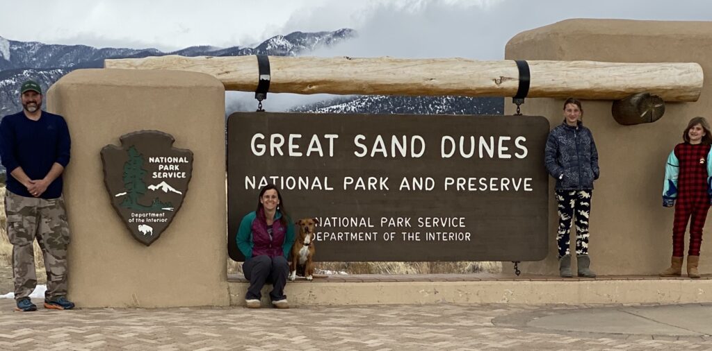
Did some needed cleaning along with few RV repairs and headed off towards Great Sand Dunes. We are excited to rent a sand board and go sledding before a storm is supposed to roll through tomorrow.
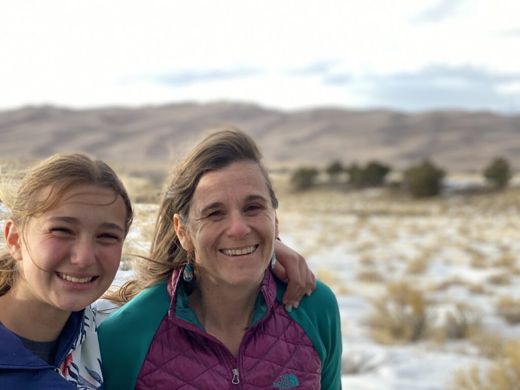
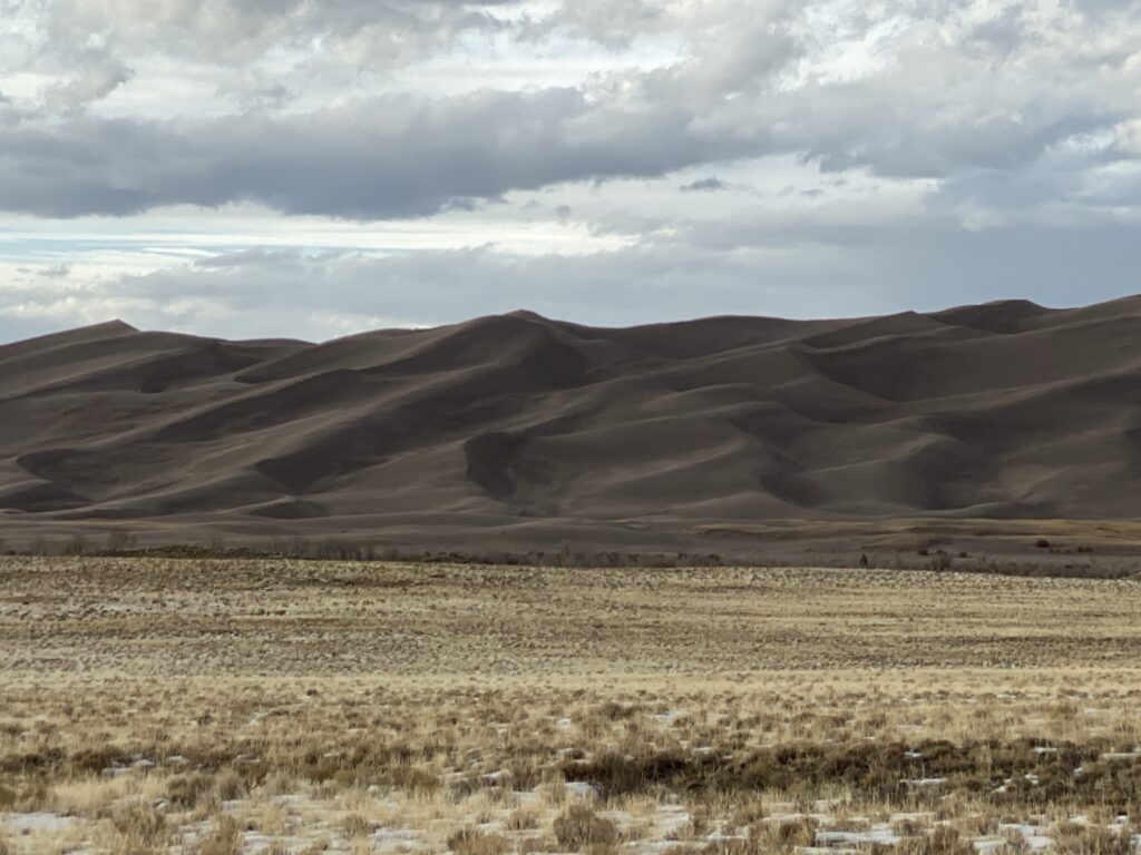
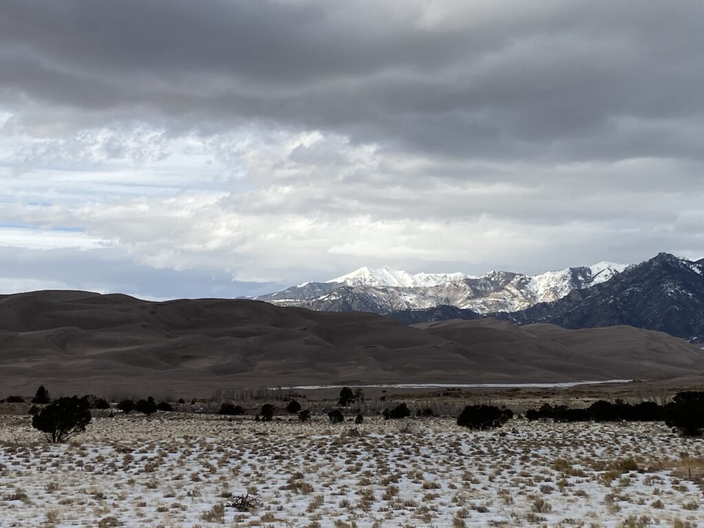
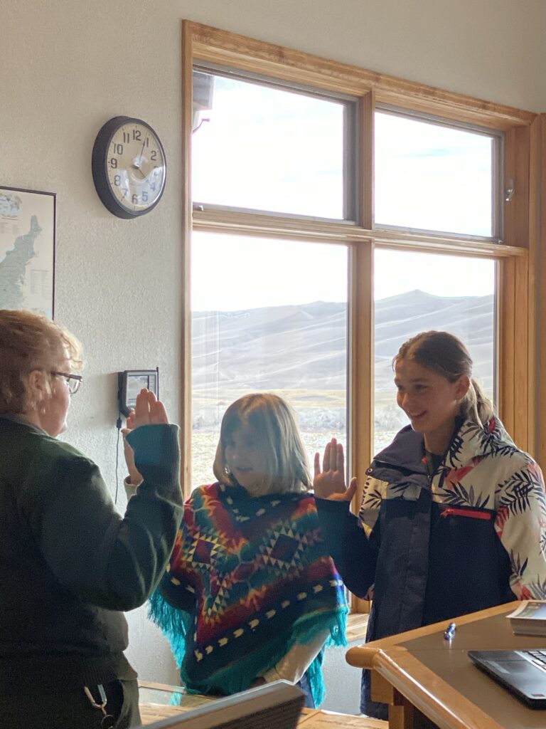
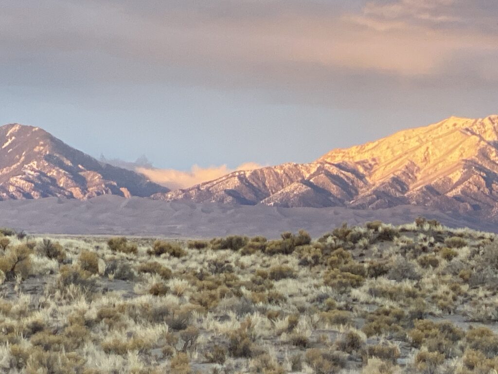
Great Sand Dunes National Park. 26th National Park.
We miscalculated a bit…we shouldn’t not have been worried about a storm, but rather looked at the weather for wind. It was so windy it was hard to make it to the visitor center without getting blown over.
So needless to say we did not make it sledding or playing around the dunes…because it was really that freezing. And it’s not really enjoyable to run around sand while you’re cold and getting hit in the face with sand during a sandstorm. We were bummed that we are here now…but part of doing this trip is we can’t go to each park/area at the optimal time. We have reserved ourselves to coming back in May or June on our way back through because it looked really fun.
The park contains the tallest sand dunes in North America at 750’ tall. The dunes are at the base of the Sangre de Cristo Range of the Rocky Mountains.
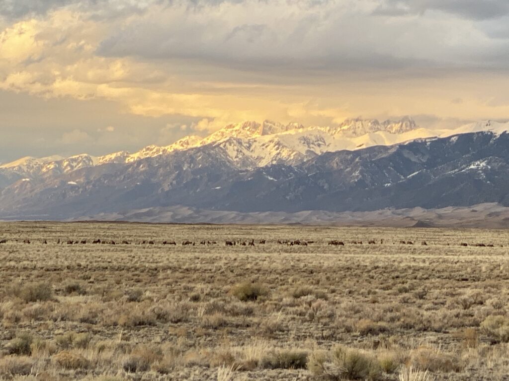
Sunset light as we were leaving
This amazing 100+ herd of elk
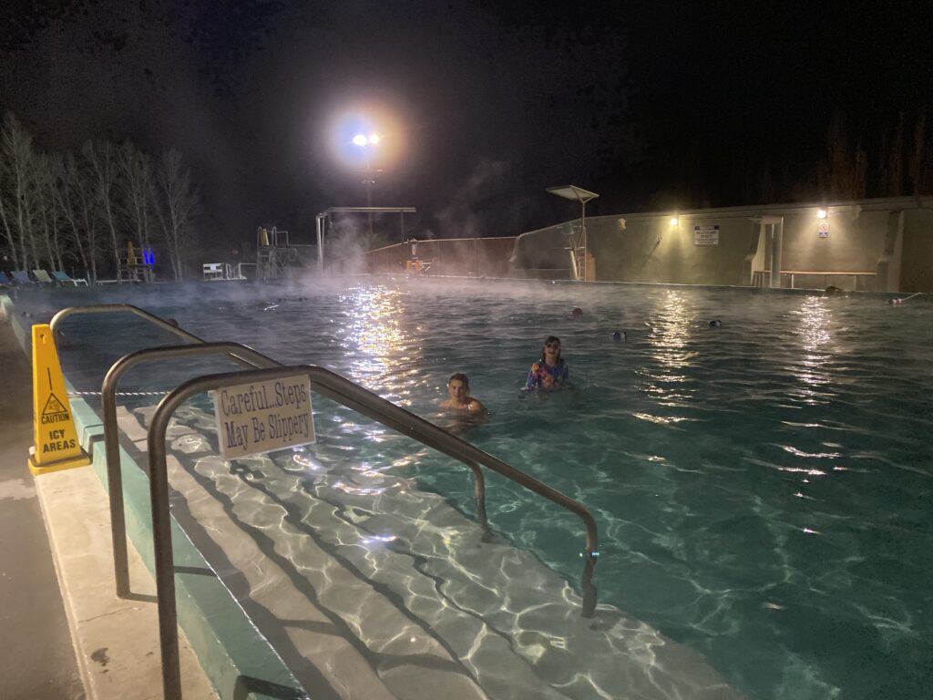
We camped out at the hot springs right next to the dunes. We had good 2 hour swim before bed.
They had this cool greenhouse 21+ with all these plants.
We got back to the RV and the girls made no bake peanut butter cookies. They were delicious. That’s been one thing that’s hard on the trip…we/the girls want to bake and baking in an RV is not exactly easy, realistic, or doable.
We had a great camping spot on the river last night. There’s snow on the ground here, but not too much to be a bother. Most places are closed in the winter, but we are nice and the caretaker of the Pagosa Riverside Campground let us camp there anyway.
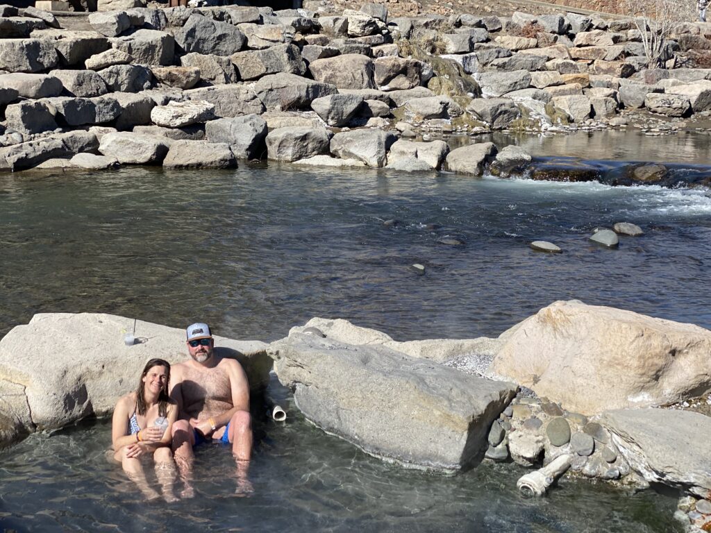
We had a great day being lazy and enjoying the springs.
It was beautiful setting on the river, that you can’t argue with. But to show a big picture of a giant pool, that ended up being a pond that you weren’t allowed to swim in as your main picture was a total switcheroo. That photographer is making them a lot of money.
Pools right along the river This was the super hot one right along the river.Edwin of course did a dip in the cold San Juan River
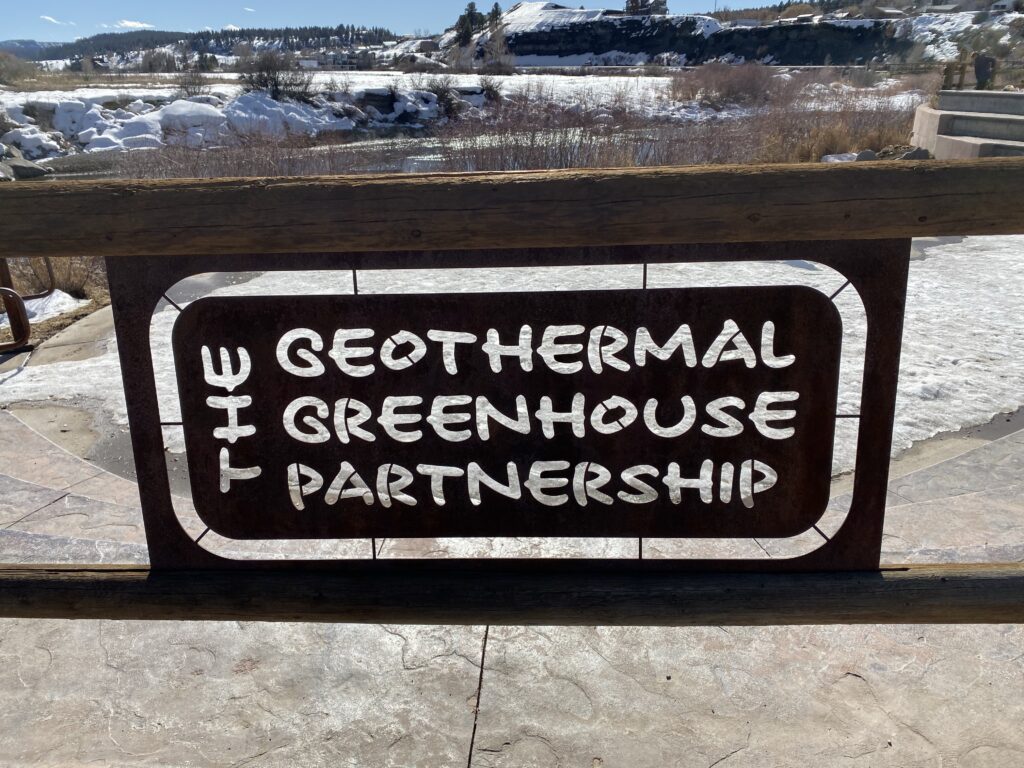
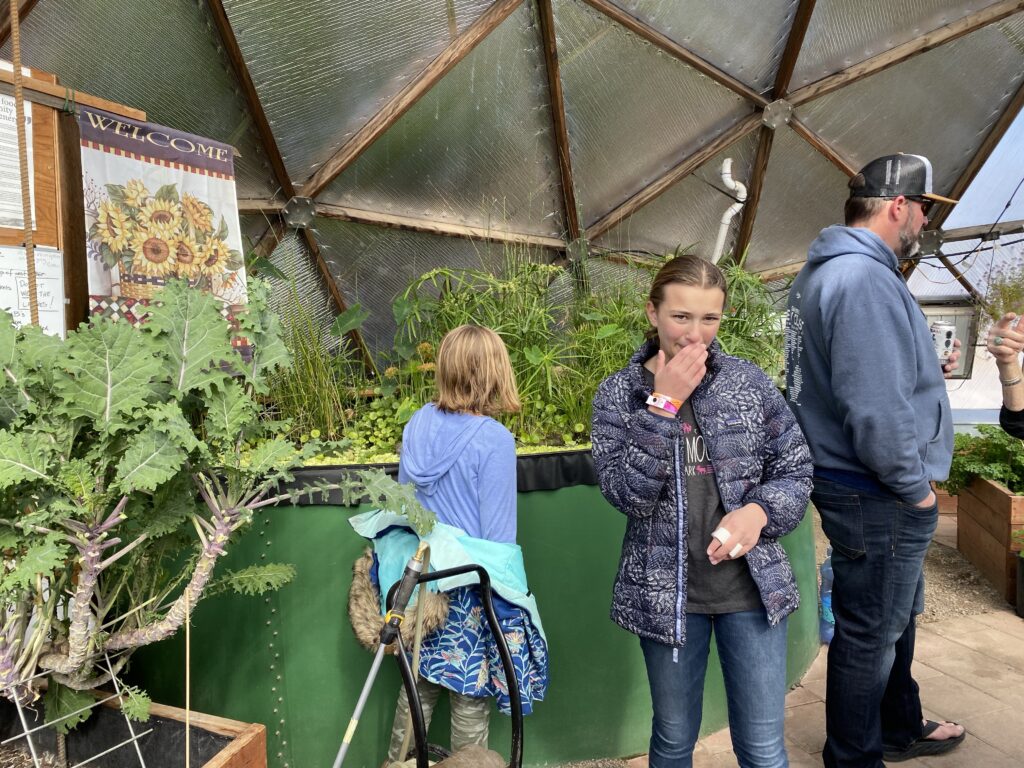
We left for a bit in the middle of the day to go get lunch and walk around town. We had driven by and were curious what these geodesic domes were so we went to check them out.
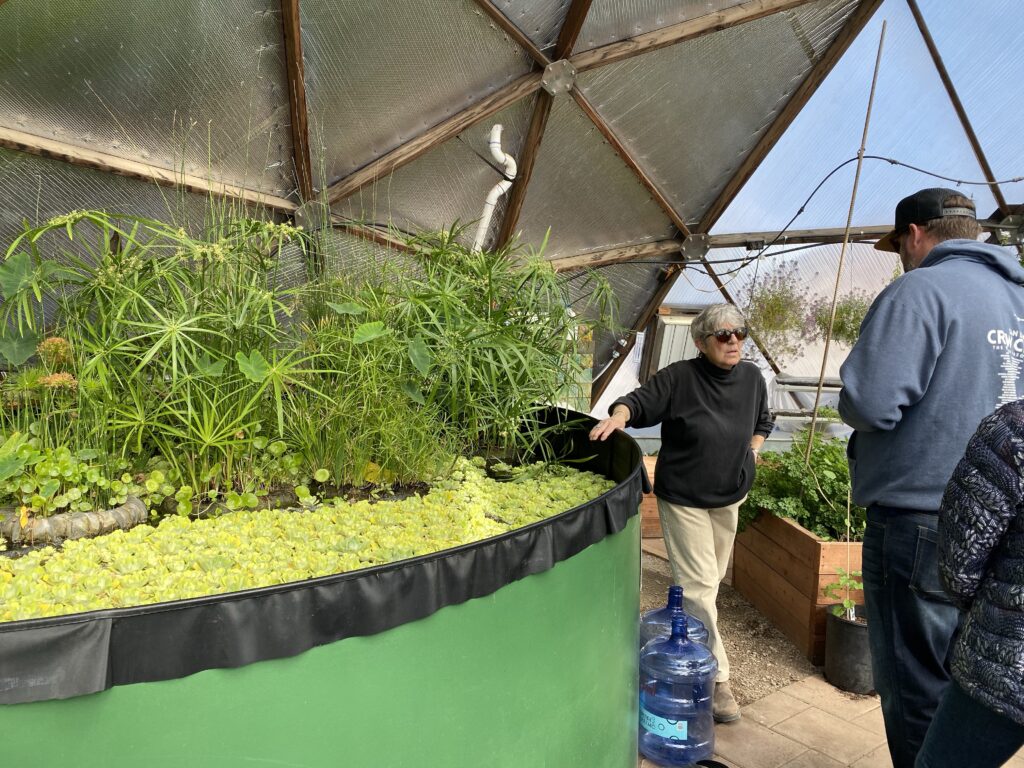
It’s this great little geo thermal greenhouse where research is done, 5th graders learning lab, and they also sell their produce to the community on a donation basis. They use naturally heated groundwater (geo thermal ) Used which is not suitable for growing to heat tapwater through a heat exchanger in a geodesic dome to heat a large pool they used as a thermal heat sink to keep the ambient temperature roughly the same all the time irrespective of season. www.pagosagreen.org
Kale on the leftWe left with a bag of veggies and an aloe plantEating our kale for the dayThe parsley was especially good.Edwin found a friend
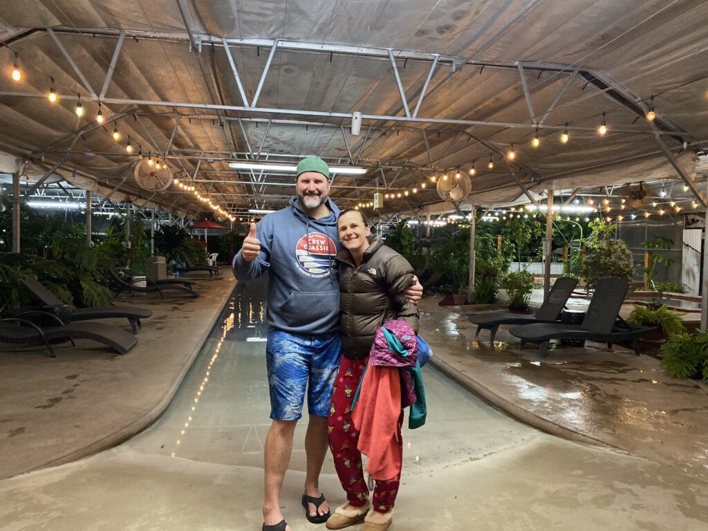
We went back for the afternoon/evening. That’s when it’s especially nice seeing the steam rising from the hot pools.
Not sure if just because I was really looking forward to it or the advertisements of the springs were amazing, but the Springs at Pagosa was NOT a 4/5 star facility as advertised.
And we were all so looking forward to the showers. Mine was luke warm/cold and the men’s locker room was a makeshift thing outside. Edwin said (after he anticipated my unhappiness) because he himself took a shower in what he called a “makeshift garden shed”.
It was a great day, but I did my share of complaining…not because I was having a bad day or that it wasn’t a nice place, but they advertised it as a super fancy and nice, showing a big pool etc… and it did not live up to it…at least not for me, nor the kids. Because it was a lot of hot tub pools and not somewhere “fun” for the kids to play. But really if it didn’t advertise as such, and charge like a fancy place I would not of been bummed. The locker room situation was ridiculous. If it’s advertised as a nice spa place, it SHOULD at least have nice locker rooms. And I’m not the pickiest… but it’s a problem if at the end I would’ve preferred to take a shower in the RV.
The RV shower isn’t bad actually. It’s roomy enough. Good water pressure. And it gets hot. The 2 issues are the water is constantly changing temperature so as the hot water runs out it gets cold for a minute before it warms up again. Which that is minor to the biggest problem if RV showers is to conserve water it’s always…turn water on to get wet, turn of to suds up, turn back on to rinse off, repeat etc…so basically it’s a luxury to have running water at your preferred temperature for the entire duration of a shower.
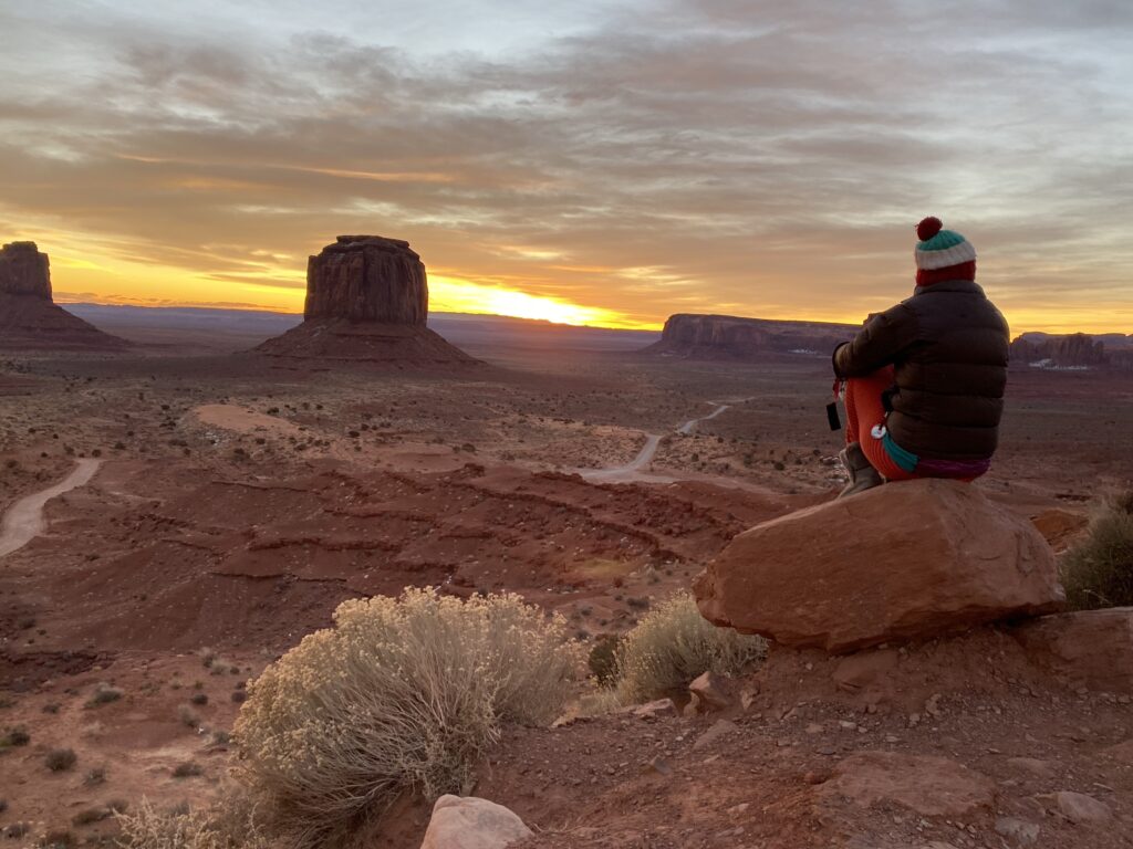
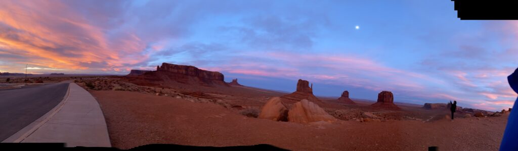
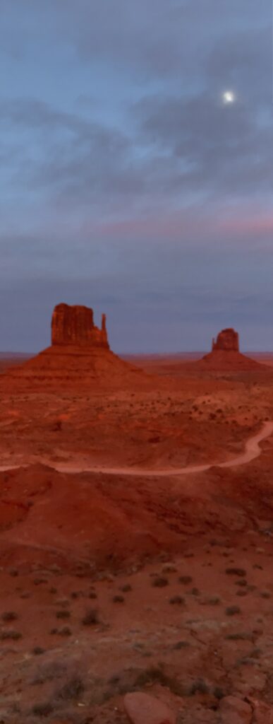
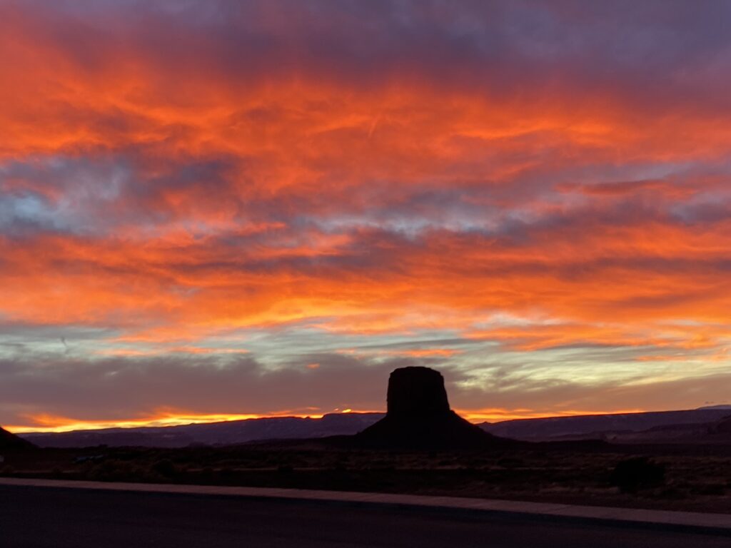
Ok busy day. Still more driving, but a good day. We woke to similarly amazing sunrise this morning at Monument Valley.
We decided against driving through monument valley. It would require another Jeep tour and since we just did that yesterday we weren’t up for doing it again. We were out of Monument Valley by 7:30am.
We were satisfied with our sunset and sunrises for now. We drove the scenic way next to monument valley heading to 4 corners.
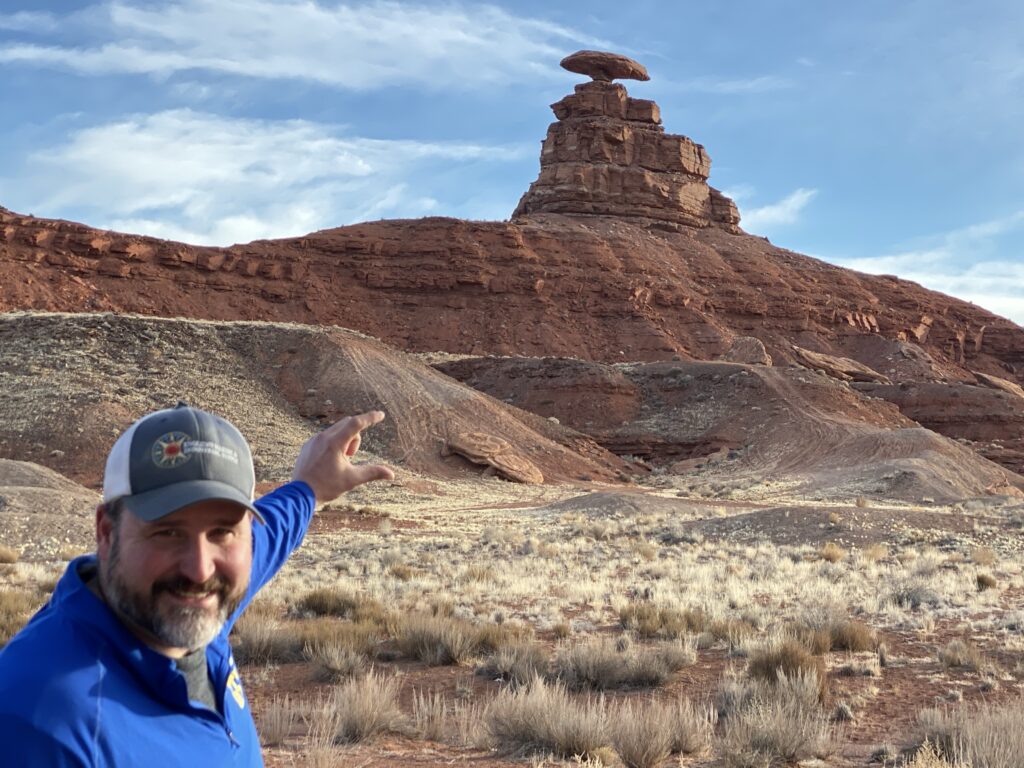
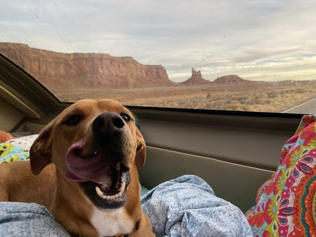
We We Mexican HatDaisy enjoying the views of monument valley An upside down sombrero
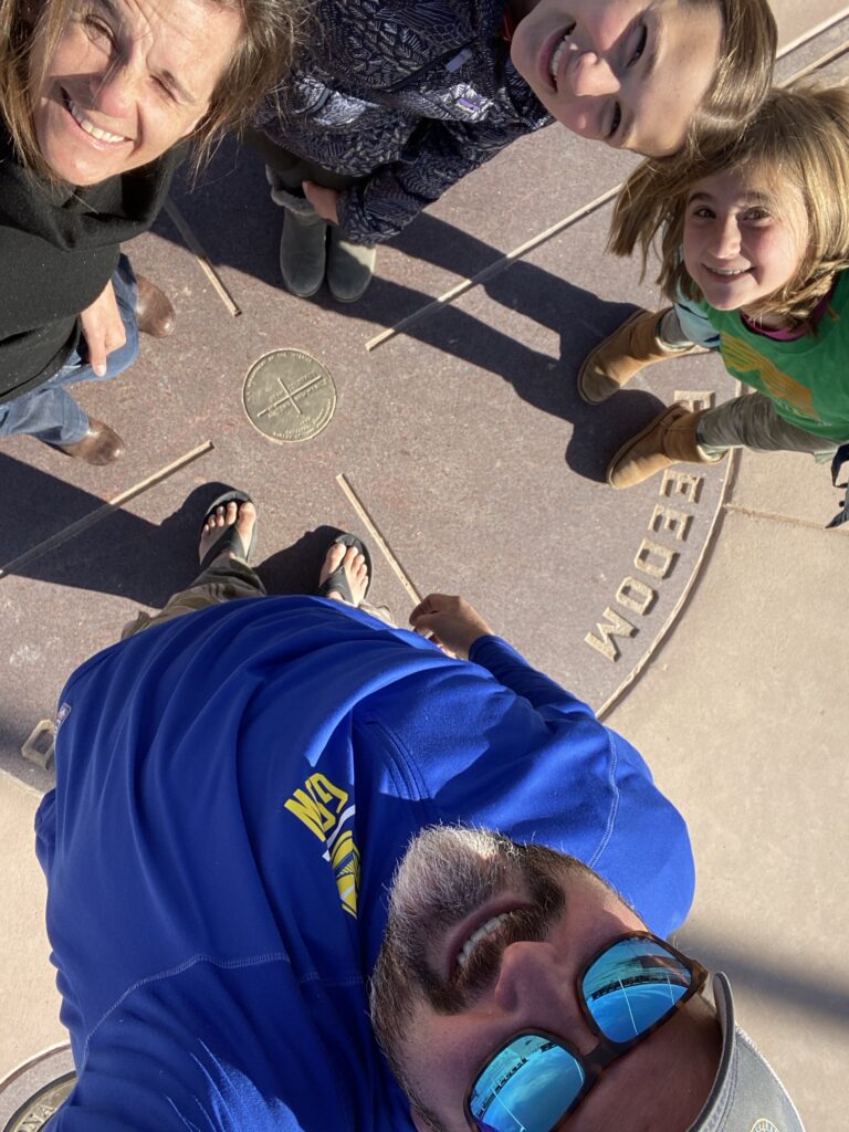
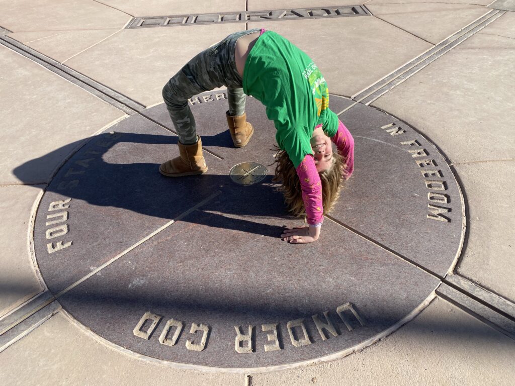
We arrived at 4 corners. Four Corners. The only place where 4 states come together at one point. Arizona. Colorado. New Mexico. Utah.
We drove in 4 states today!
Edwin and I were here 20 years ago when there was no entrance fee and no built out vendors. We all had fun jumping across state lines walking around the vendors. Barely anyone there but thankfully a few vendors to shop around. I still remember the ting I bought there 20 years ago.
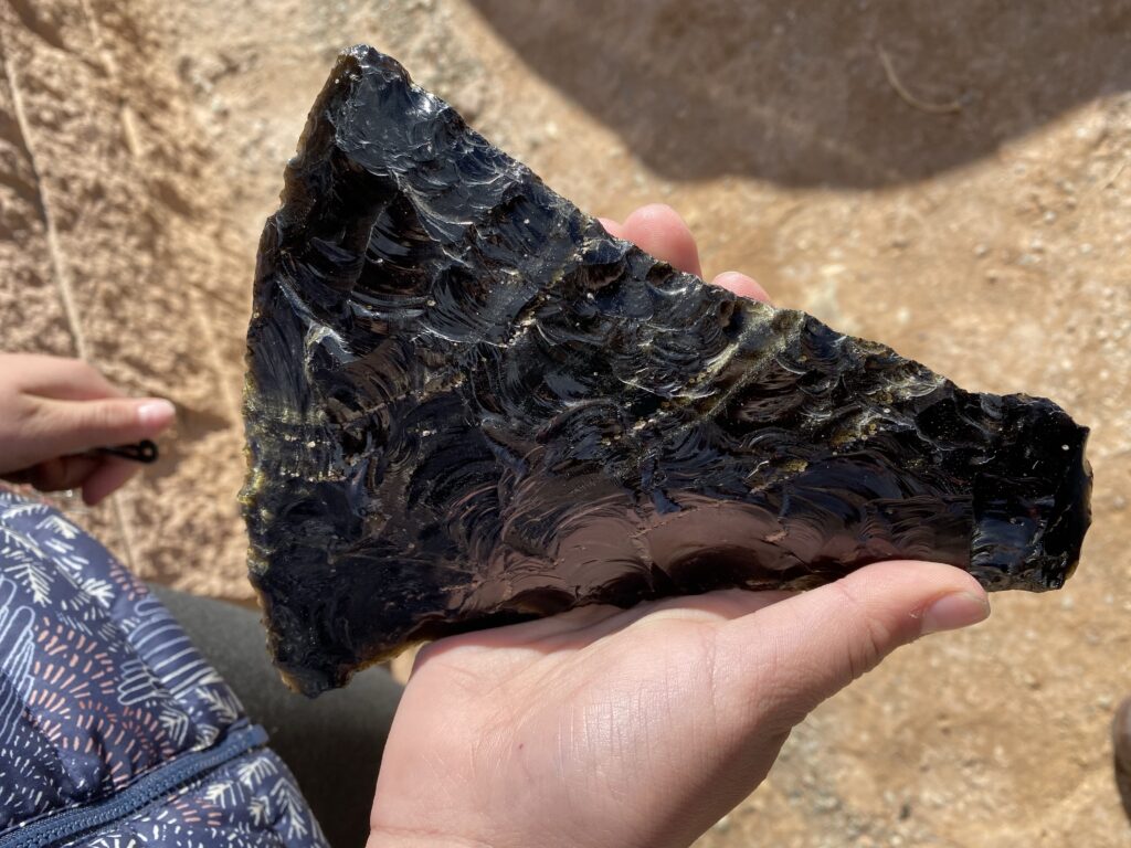
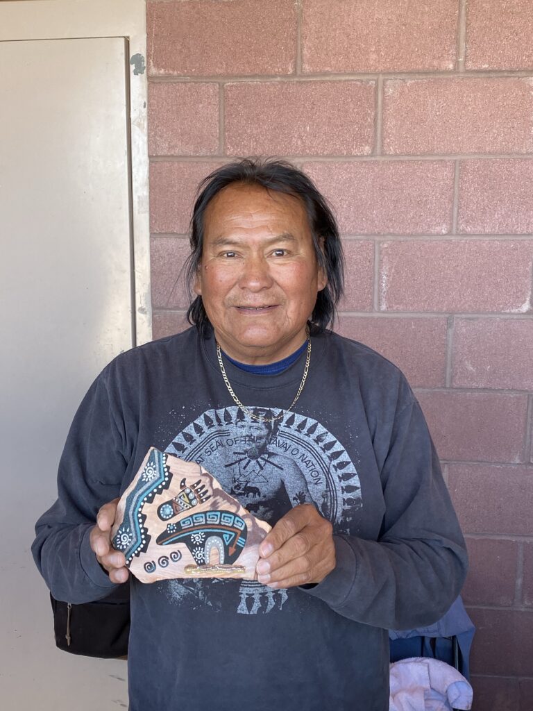
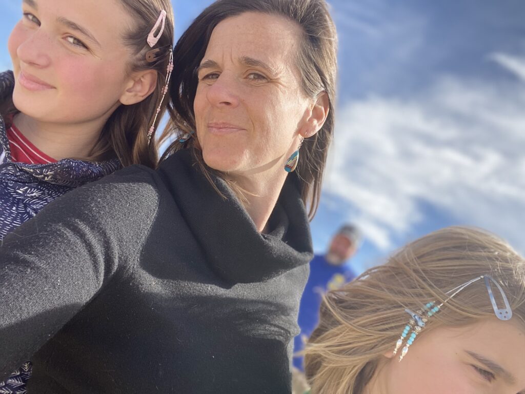
We’re a world away from each other in different states. Kati~Utah. Isabella~Colorado. Vera~New Nexico. Edwin~Arizona.Vera is in 4 states at once Craig made beautiful arrows, one of which Edwin purchased.He had a large piece of obsidian with real gold flakes inside. Of course can’t really see in the picture, but rare, and it was very neatWayne learned beautiful sand painting from his grandfather, and is teaching his grandkids Us girls showing off our new flair. Some earrings for myself and hair beads for the girls
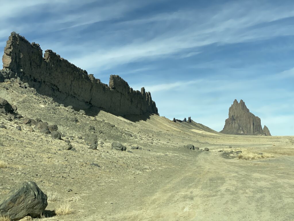
Shiprock is very close by and on the way to Mesa Verde National Park which was our next stop. We’re trying to get in and out of there today so we can get to some much needed hot springs.
Edwin and I camped at Shiprock 20 years ago when we were through here. We camped right along the foot of Shiprock. To the point where I remember we though it would be a good idea to drive another 20 feet away since we were seeing car size boulders all around us. How did they get here?? As we look up. What I do remember is that it was and still to this day (well maybe the one at Mesa Arch 2 months ago) rivaled it. We realized after or the next morning we were not supposed to be camping there. That we were in Navajo land. I don’t remember if we were unaware or just didn’t care at the time…but I think we didn’t see any signs and drove the dirt ride out there. Now returning I’m pretty sure that was not allowed. This time we just pulled over the side of the road, shared our stories with the girls, and took some pictures.
Very cool thin random geological feature that I don’t rememver
Back in Colorado, heading towards Mesa Verde.
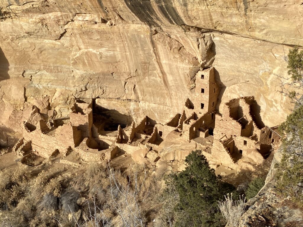
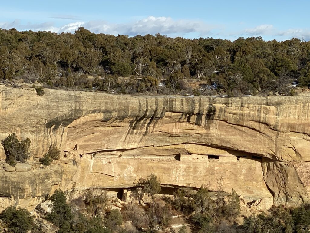
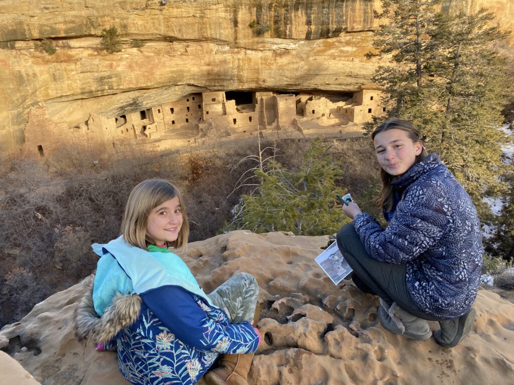
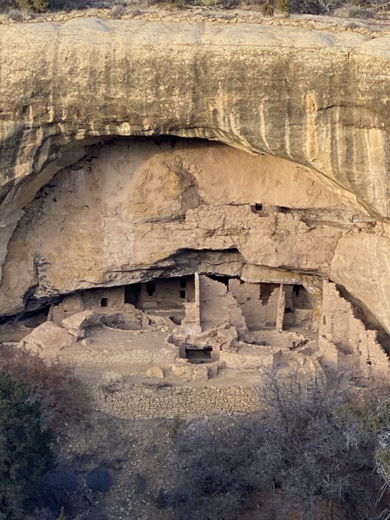
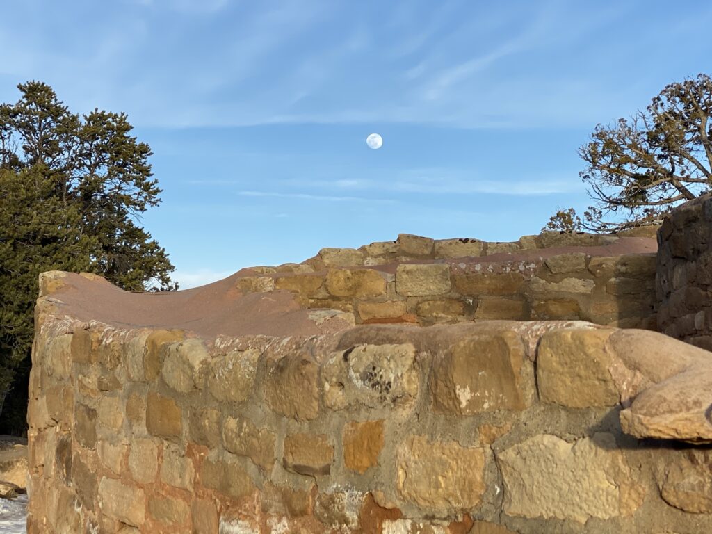
Mesa Verde National Park. 25th National Park.
ode to Cliff Dwellers
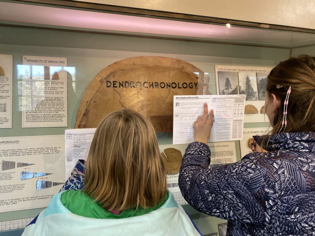
We got there with enough time to explore the park in the afternoon, but not enough for the whole knowledge tour as well. Luckily since we just came from Canyon de Chelly we had a good background on the Anasazi people, the ancient puebloans from 600-1300AD.
Another national park created by president Teddy Roosevelt. It is the largest archaeological preserve in the U.S. Mesa Verde National Park protects almost 5,000 acres including 600 cliff dwellings. It is also part of the UNESCO (United Nations Environmental, Scientific and Cultural Organization) world heritage foundation of which there are only 10 worldwide.
The Anasazi were farmers and hunter gatherers. In 600AD their homes began as pithouses. They were dug underground with tree limbs used for a roof. The home entrance was in the roof. Then in about 750AD they transitioned to above ground pueblos. During these times they lived up on top of the Mesa. Later they became cliff dwellers and made homes in the natural alcoves. They would climb up and down the canyon walls via hand and foot holds and 60’ ladders made from trees. You can climb around a few of them in the summertime. By 1300AD they disappeared from the area for unknown reasons.
No camping in the park right now and we really want to make it up hot springs. So off to Durango.
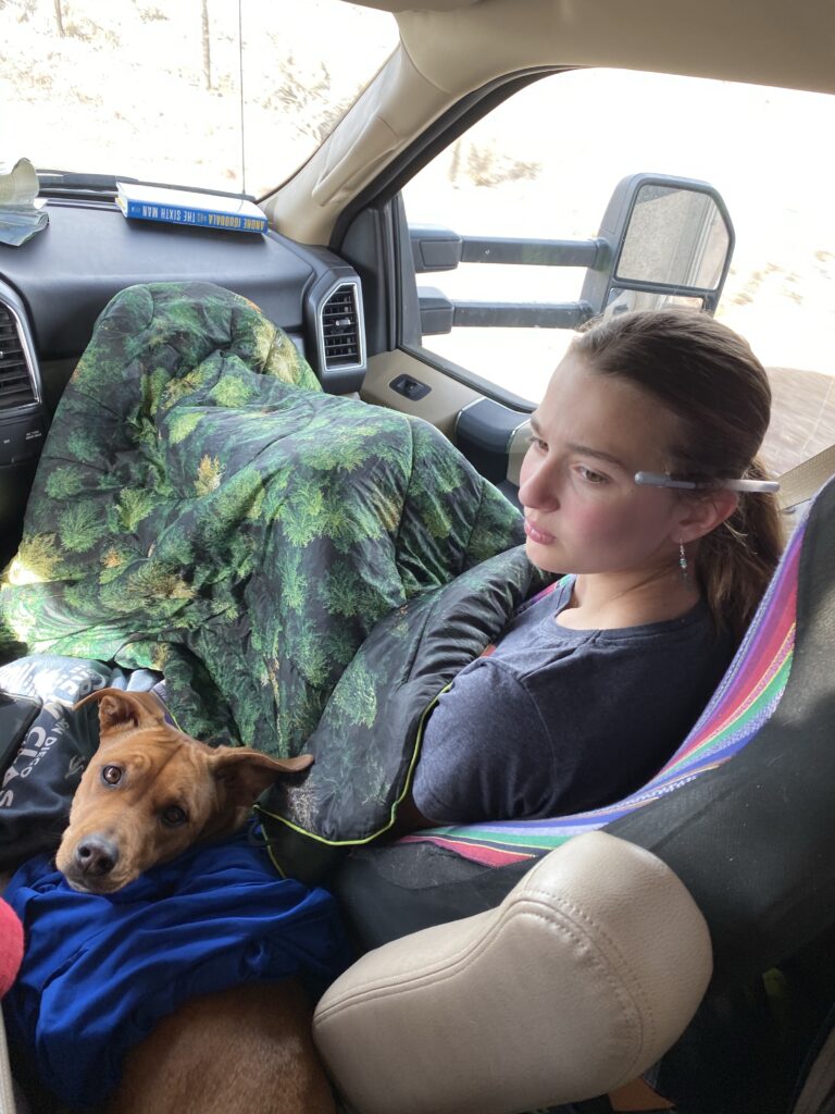
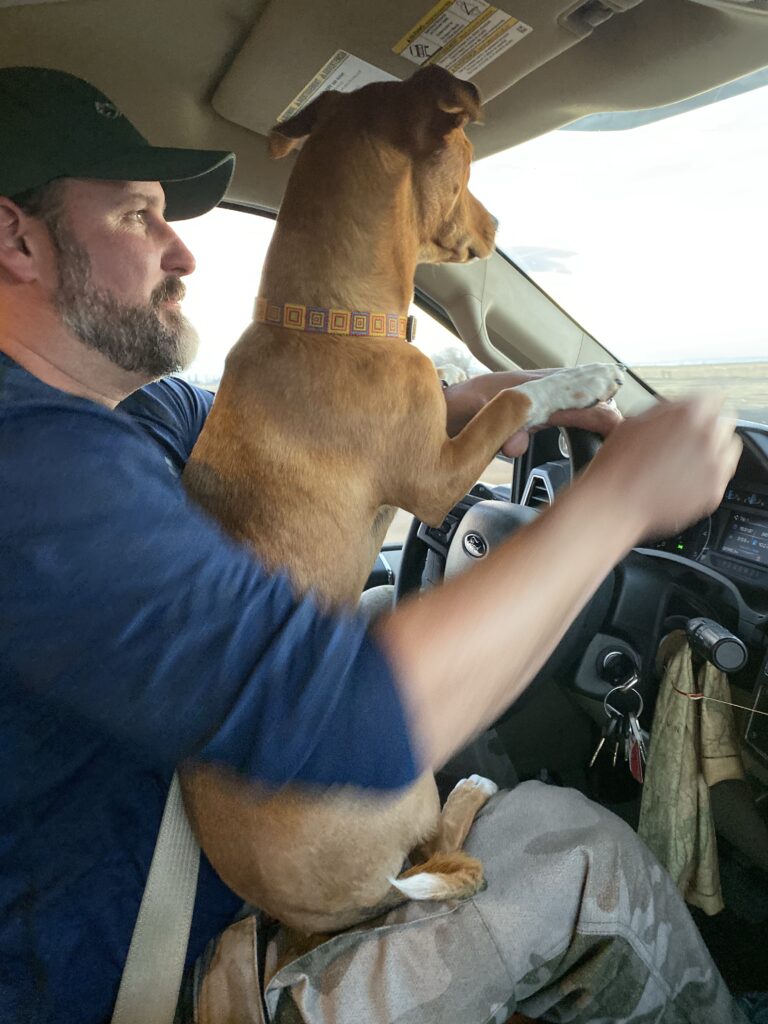
This is not an uncommon occurrence… Often Daisy and I fight over the front seat. I got up to make dinner to sit back down to Daisy not moving. Most of the time I kick her out, but this too is not unfamiliar…
We’re in Pagosa Springs. I’m almost giddy. We have a great spot along the river and we are going to hang out all day and stay in the same place for a second night which we haven’t done in about a week. Overdue. Goodnight.
The Navajo people call this place Tseyi – place between the rocks. Navajo people refer to themselves as Diné. There are 3 canyons here, Canyon de Chelly (pronounced shay), Canyon del Muerto, and Monument canyon.
Canyon del Muerto on the left, is the north canyon. Canyon de Chelly is the south canyon on the right
The canyon lies within the Navajo nation and is solely owned by the Navajo Tribal Trust. It also protects and preserves ruins from the ancestral puebloans, the Anastazi people who lived here from Round 700-1300AD and the Hopi who used the canyon before the Navajo.
The crankiness of yesterday was still lingering this morning and nobody wanted to move. Thankfully Edwin motivated and found us this.
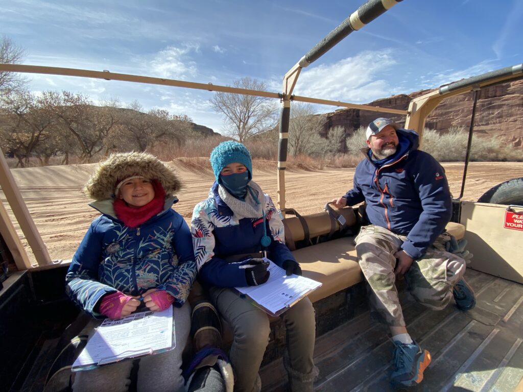
You are not allowed in the canyon without the company of a Navajo member. So there are Jeep tours, horseback riding tours and the Pinzgaur tours, an Austrian troop carrier. Edwin has long wanted to ride in one of these so it was done and he was happier than a kid in a candy shop. He got us motivated but also cautioned “dress warm” as it was still pretty cold and we’d be in an open air vehicle.
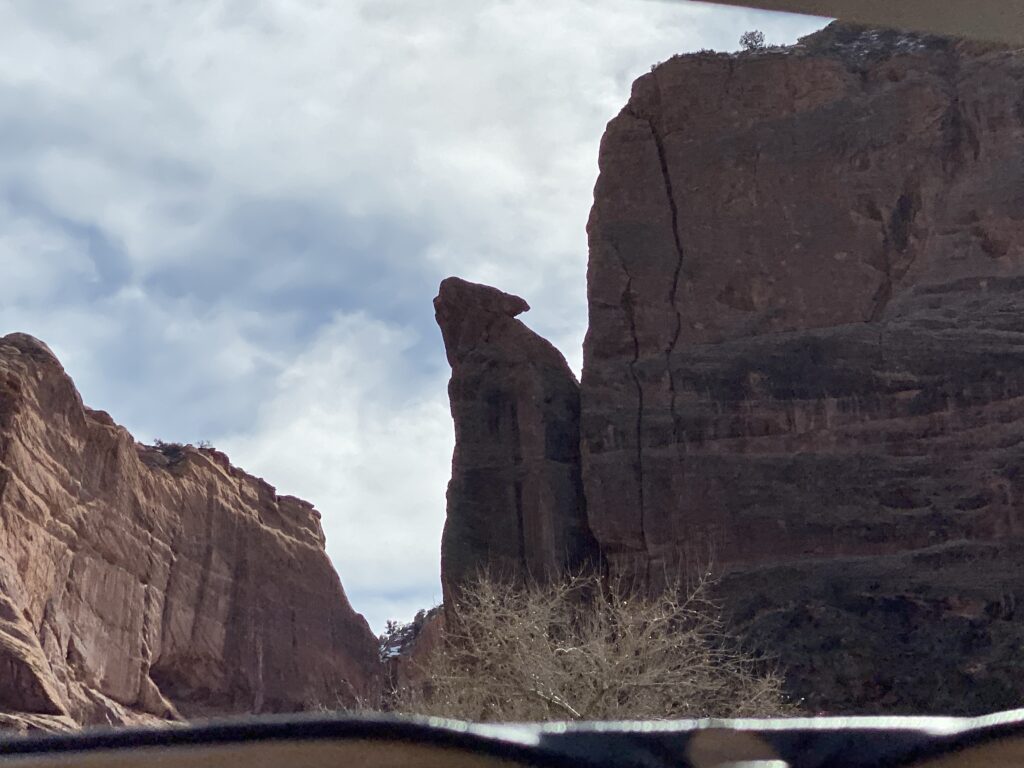
This is the mouth of the canyon, inside the canyon walls are over 700’ tall
The Navajo still use and live in the canyon to this day. The Navajo used to live in the canyon for about 8 months a year. They leave the canyon in the wintertime where it is not as cold. According to “info/sources” about 50 families still live and use the canyon, but our tour guide David, who grew up inside the canyon, says it’s only about 10-15 families and generally only the elderly. They will come down around March until November. Families with children will only return in May after school is over, but generally do not stay in the canyon, rather bring supplies to the grandparents, visit, but then exit the canyon at the end of the day. There is no water in the canyon so water is brought down in barrels for cooking and drinking. Often, David says, you will find grandparents with young 3-11 year old children living in the canyon through the summertime. “The Navajo come down for ceremonies and for the day but not many live in the canyon. There is no running water, no electricity, no TV etc…” David is a Navajo tour guide, grew up raising sheep in the canyon, but does not live in the canyon anymore. There are still cows and horses in the canyon. And the elderly still plant crops such as corn, alfalfa, squash and have orchards of fruit trees.
Cottonwood trees are native to the area. Unfortunately the government planted Russian Olive, a non-native species that now no one can get rid of and is taking over
There are both pictographs and petroglyphs from the Anastazi, Hopi, and the Navajo people. The one below shows Navajo hunting deer on horseback. They would follow the deer until it got tired and lay down. Then they would put blessed corn 🌽 pollen in the nostril or the mouth of the deer to suffocate the animal. This would ensure a full buckskin minus any holes.
The Anastazi pictographs and petroglyphs are about 15’ higher on the canyon wall. This is because the canyon floor also used to be about that much higher.
The horizontal line right below the cave shows where the canyon floor used to be.
The Anastazi people made these pictographs. Below you can see hand prints, showing life. The negative hand print below and to the left shows a death and that someone was buried here. The Anastazi lived in the canyon year round. The Navajo do not and have their burial grounds above the canyon.
The Navajo lived in summer homes called Hogans. A hogan is made out of timber packed with mud often multi sided like a hexagon. The Anastazi lived in the canyon year round and were cliff dwellers.
The Anastazi homes inside the cliff overhang.Their homes were rectangular at with a circular building, called a kiva, in the center for ceremonies.standing bear2 owls 🦉
The reason this side of the canyon is called Canyon del Muerto because of a massacre that ran for 2 days when the Spanish shot into a cave and killed 115 women and children in a cave. The 2 circles are to show the 2 days of killing.
Of course we can’t hear Native American stories without it ending in tragedy, Below is Fortress Rock. In 1863 Kit Carson went to the canyon to drive the Navajo out. A number (unknown) went to top of Fortress Rock and stayed up there 3 months during the winter. Eventually the Hogan’s were burned as well as the trees, crops, and orchards and the remaining Navajo were driven out of the canyon.
1864 marked the “long walk” where 8,000-9,000 Navajo men, women, and children walked to Fort Sumner, in New Mexico. The government was trying to put them into reservations in Kansas, but they wanted to return to their land. In 1868 only 2,000-3,000 Navajo returned to this land and began using the canyon in the way they do today.
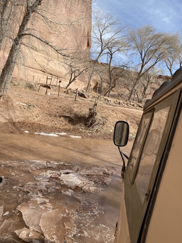
Fortress rock.The White House ruinsWhite household ruinsDriving through the wash
Enjoying the last bit
Everyone was happy to be out of the RV even if it still meant bouncing and around a truck. It was quite fun driving in the deep sand and drive through the winter stream run offs. In the end we had quite a good day. And because we dressed in about 18 layers and brought blankets we were quite cozy.
We didn’t make it to Spider Rock, one of the geological rock formations Canyon de Chelly is known for because we opted for the canyon floor tour. We were tired and weren’t up for driving them rim and we were trying to make monument valley for sunset. Good thinking…because…
We are all cranky today. None of us want to be here, or in the RV, or together. I think part of is just timing…we left Truckee 2 weeks ago and have a really great 2 weeks and I think today we are all just tired. Tired of visitor centers. Tired of learning. Tired of moving. Tired of just about everything. The real kicker was that when we woke up it was 16 degrees outside. That’s right, in Arizona, it’s 16 degrees. Not only was it cold, but it was very windy.
Daisy saying I’m not going outside with a blanket Shhh 🤫 don’t tell miss Wildbrine
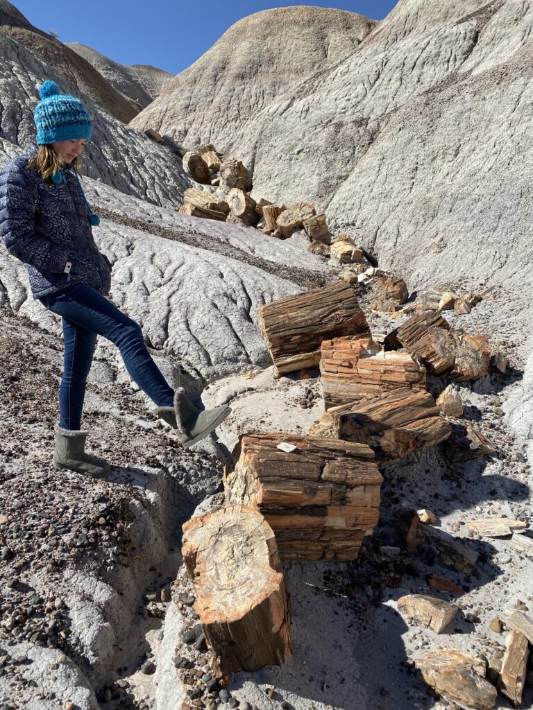
Petrified Forest National Park. 24th National Park.
Petrified Forest National Park runs right through interstate 40 and has a north and south part of the park. Unfortunately, they are doing construction on 1 mile of road connecting the two. The painted desert (badlands) are in the north and the petrified trees are in the south.
Petrified Wood. What is it? How is it formed? Petrified wood is the fossilized remains of a tree. The wood is transitioned to stone through a mineralization process.
Basically if a tree is buried quickly under enough sediment where oxygen and decomposing bacteria and fungi cannot works it’s ‘magic’ to decompose the tree it has a chance to become fossilized. The organic material in the wood is replaced by minerals found in the groundwater, mainly silica (like quartz). Amazingly it retains the same structure as the the original wood. Elements such as iron, carbon, and manganese gives the stone a beautiful array of colors.
Sample in visitor centerIt can be polished very smoothly
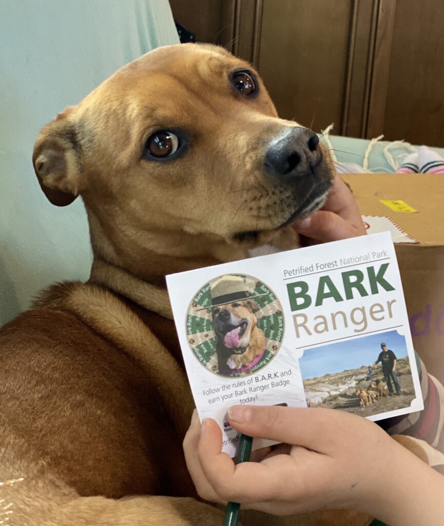
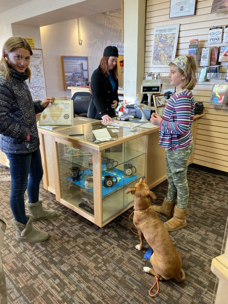
One exciting thing about the day…Petrified Forest National Park is dog friendly…and even has a Bark Ranger program.
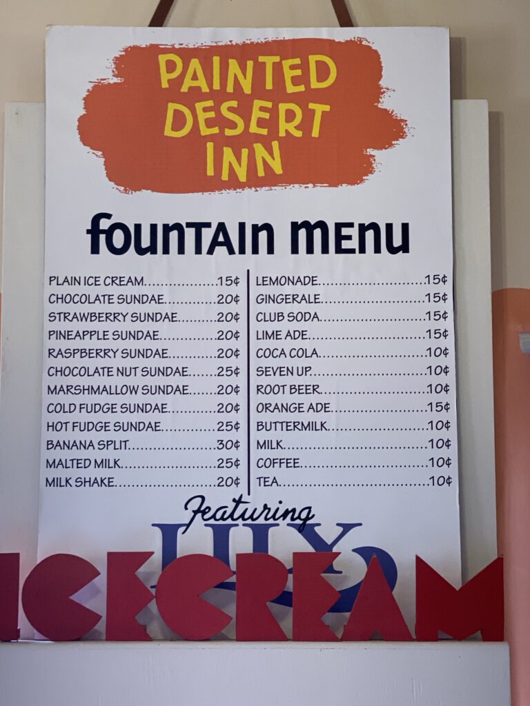
We were at the north entrance do we did the north loop. We visited the historical Painted Desert Inn built back in the 1920s.
The Salt Lake Mural. It tells the story of two young Hopi men on a salt gathering journey. They walked 230 miles from their home to the Zuni salt flats and returned home. It was both a physical and coming-of-age journey. Fred Kabotie painted this and other murals back in 1948.
Historical Route 66 also runs through the park and is one of the only places that it is still protected. We actually ended up camping on old Route 66 last night.
Newspaper Rock
We did the 1 mile Blue Mesa loop.
Petrified woodJunior Ranger Vera with Bark Ranger Daisy
Petrified wood is found all over the world however the largest concentration in one area is located in petrified Forest national Park. Of course the area that contains large groupings of wood is in the southern part of the park which we cannot access unless we detour all the way around the park. We did decide to drive the down because the petrified wood down there is supposedly much more colorful. It was only another mile walk loop, and was worth the drive and effort, but it was so incredibly freezing.
Daisy even got her own little bark ranger badgethe 3 rangers
More driving and drive 2 hours up to Canyon de Chelle. Everyone, still cranky as we’re heading to bed.
It was a nice night and nice to wake up to some company as well. And ☕️ CoffEE 🙂
So Petrified National Park next, right? Well somehow last night Edwin brought up hoe we are going to miss Saguaro National Park, which is all the way south in Tuscon. It also occurred to me that in a Tuscon I had wanted/intended on seeing an old friend from high school, the only one I really kept/liked after leaving high school, but even her I haven’t spoken to in over 15 years other than giving and receiving Christmas cards. I knew it was a bit of a long shot but I reached out to her last night. It is her birthday today, Happy Birthday Allison 🎈 (I’m still blaming Vegas for my bad planning on not quite thinking about what would happen after the Grand Canyon on this southern route…we had from Truckee to the Grand Canyon planned, but…darn Vegas. Just kidding, just really haven’t planned the southwest route out very well.
Even though us meeting up with my friend was uncertain and it didn’t make time or direction sense, we had decided to head down there anyway because our push to see the country through national parks was winning.
So I was a definitely bummed I hadn’t reached out to Allison earlier to coordinate something, and we did connect. Sorry Allison, that would’ve been fun.
It also meant for a lot of driving today, but at least I’m able to catch up in this lovely blog.
And the girls had fun dressing up as each other.
Mimi’s Cafe
We liked Arizona up near Flagstaff but not so fond of the cactus environment down here in Tucson. And the dumb Californian me is surprised to see so many mountain passes in Arizona. I thought it was all just hot flat desert.
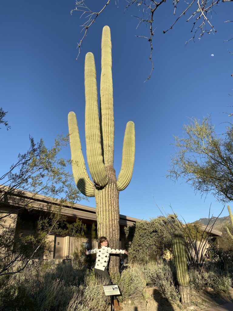
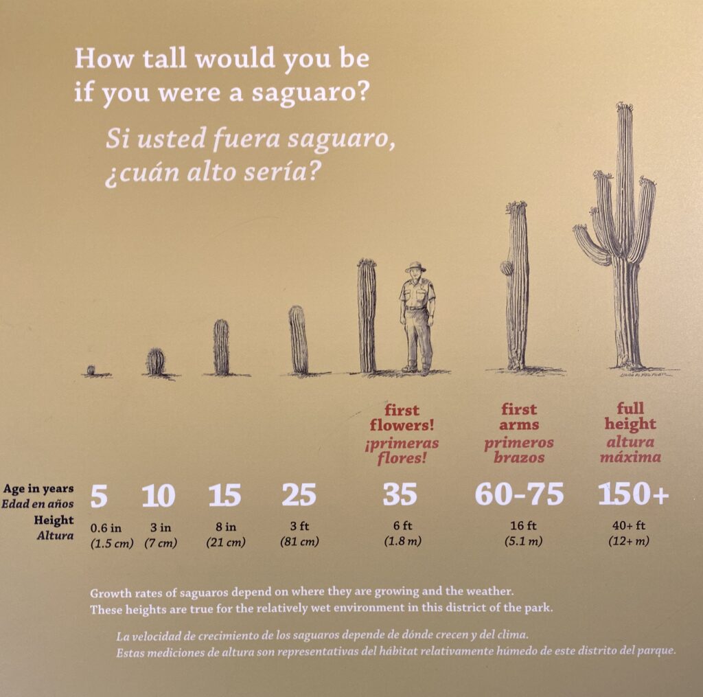
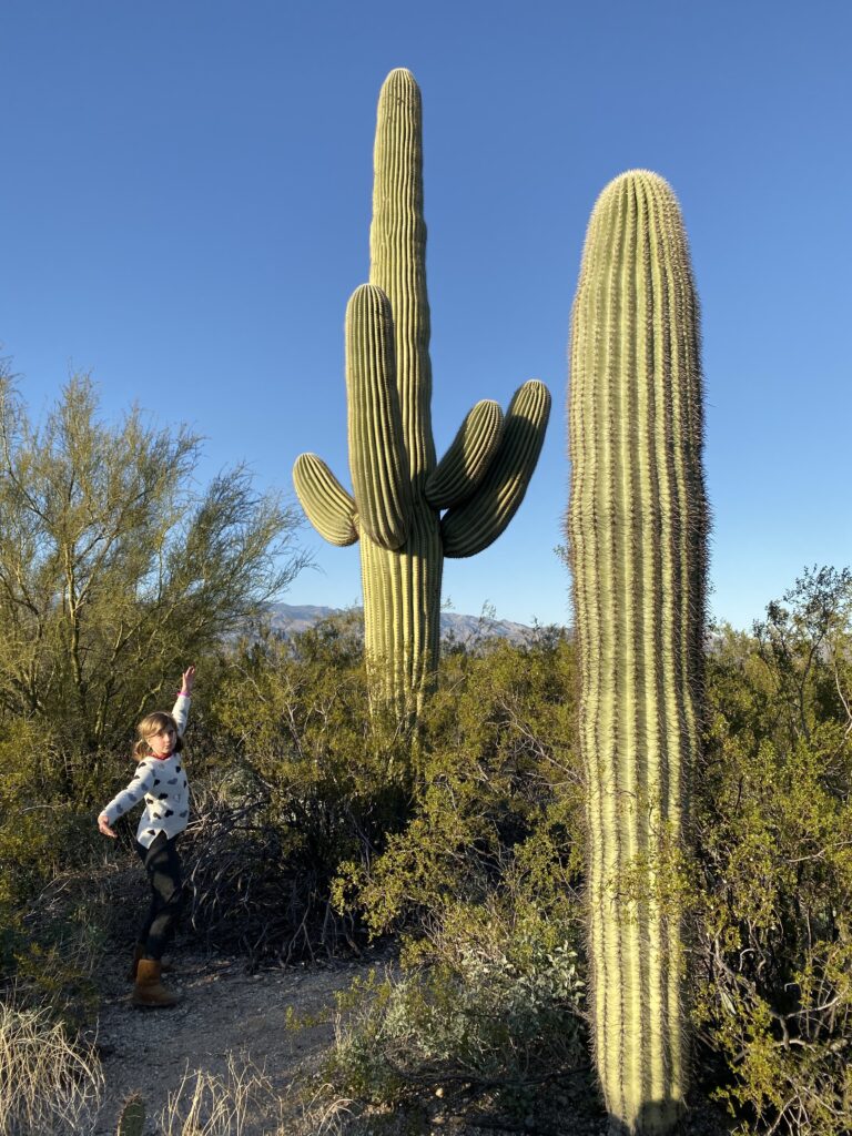
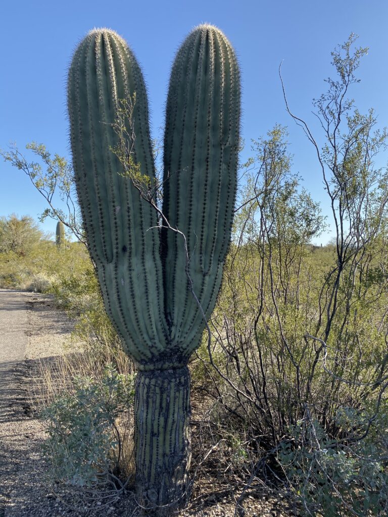
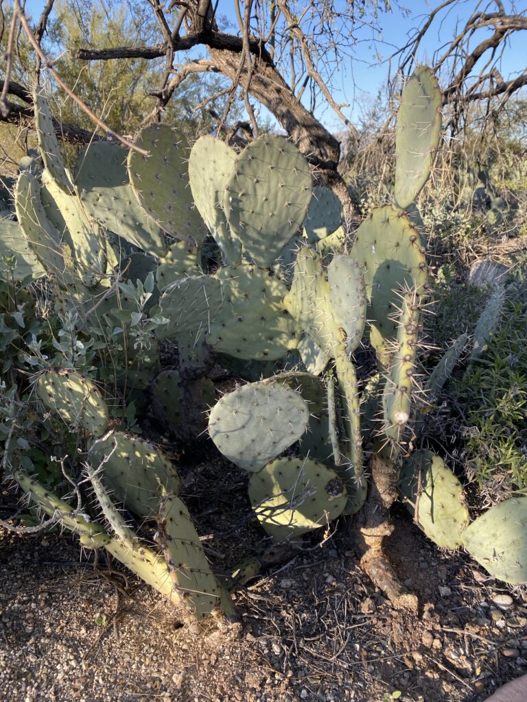
Saguaro National Park. 23rd National Park. (i think, have to look it up) Pronounced suh waa roh
It was absolutely freezing today. The wind was blowing and it was bitter cold. We didn’t explore Saguaro National Park very much. Saguaro National Park is part of the Sonoran Desert, same as Joshua Tree National Park.
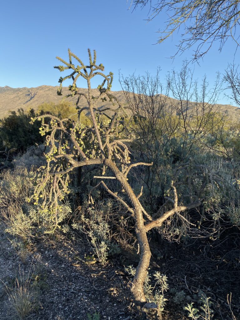
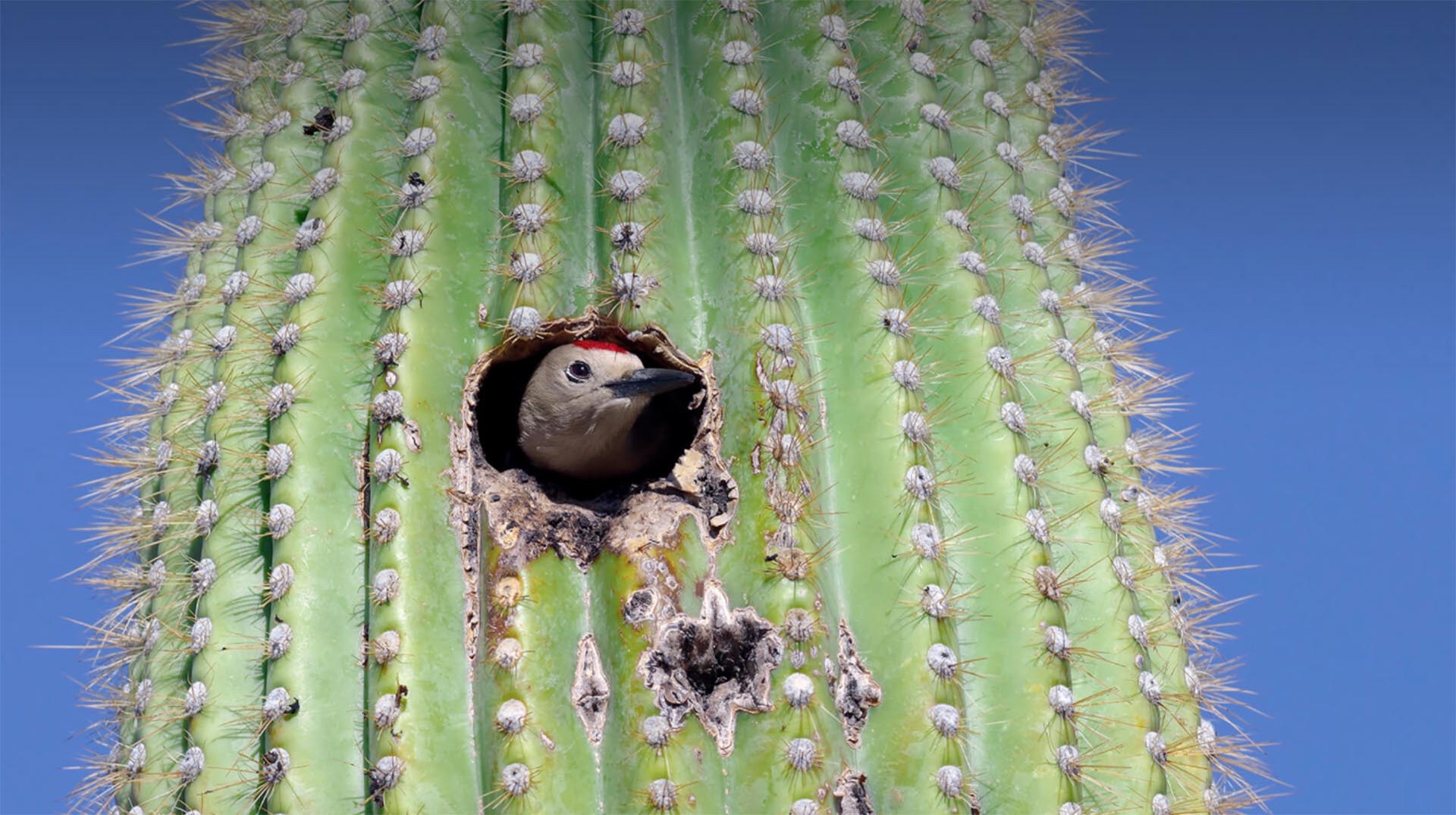
the Saguaro cactus 🌵
The Saguaro Cactus is the largest cactus and can grow over 40’ tall and live to 200 years old. It is the cactus 🌵 you draw when you think cactus. They are very good at storing water during rains to sustain long droughts. They only begin to grow their first arm at after age 60. They grow very slowly which makes them dependent on “nurse trees” (a tree that provides shade, shelter, and protection) for the growing cactus.
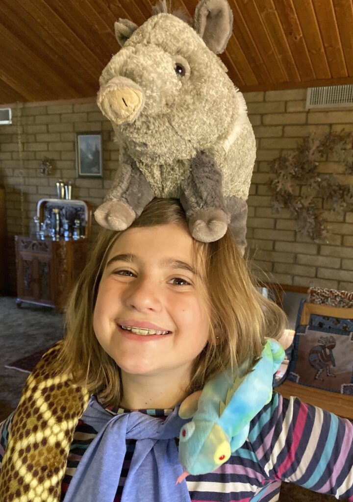
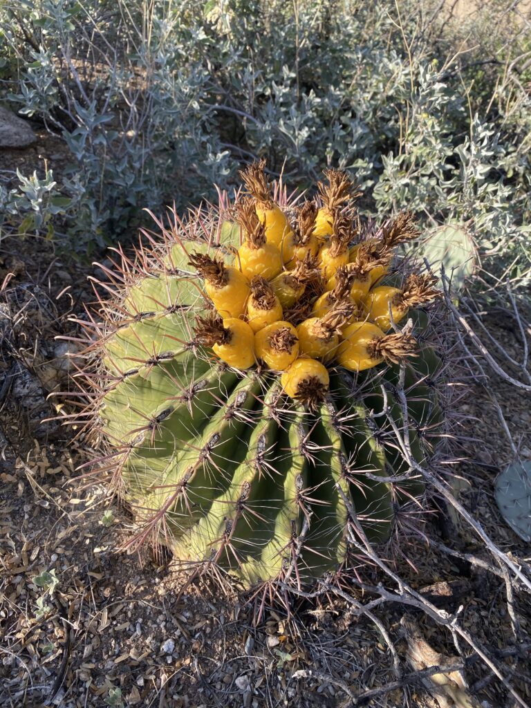
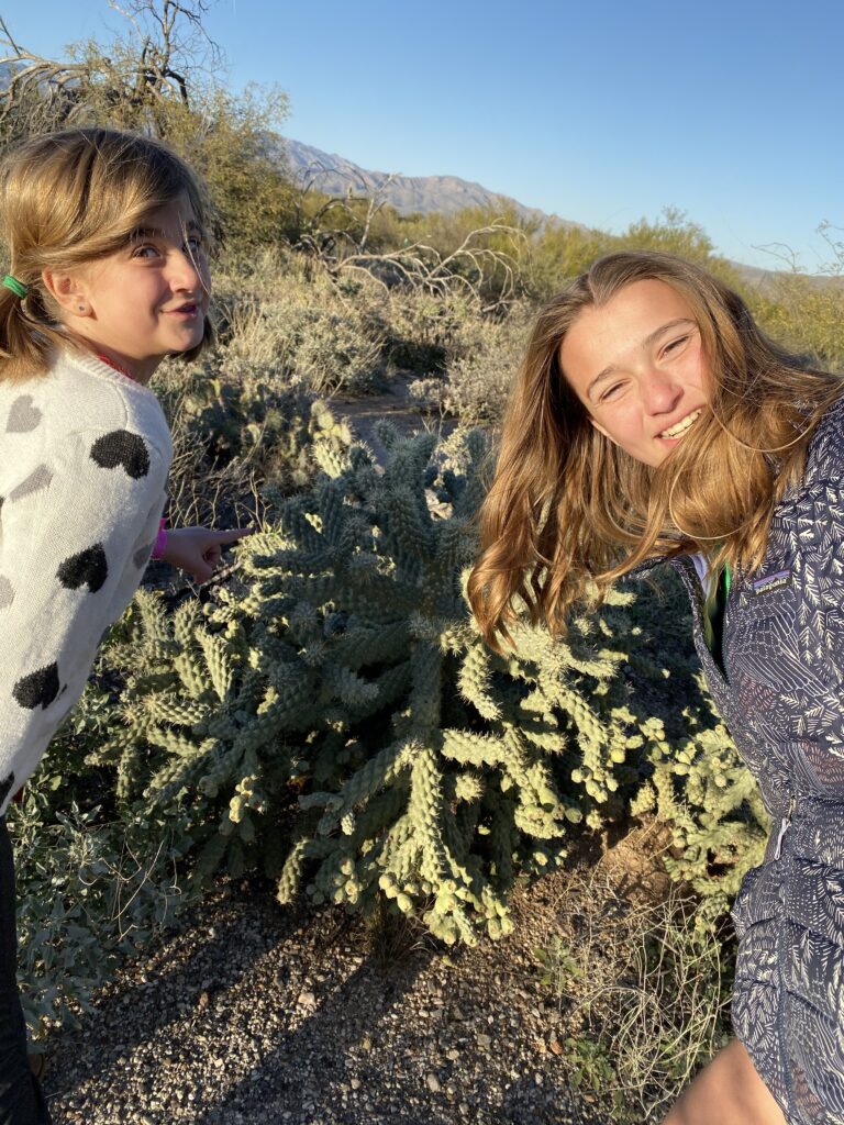
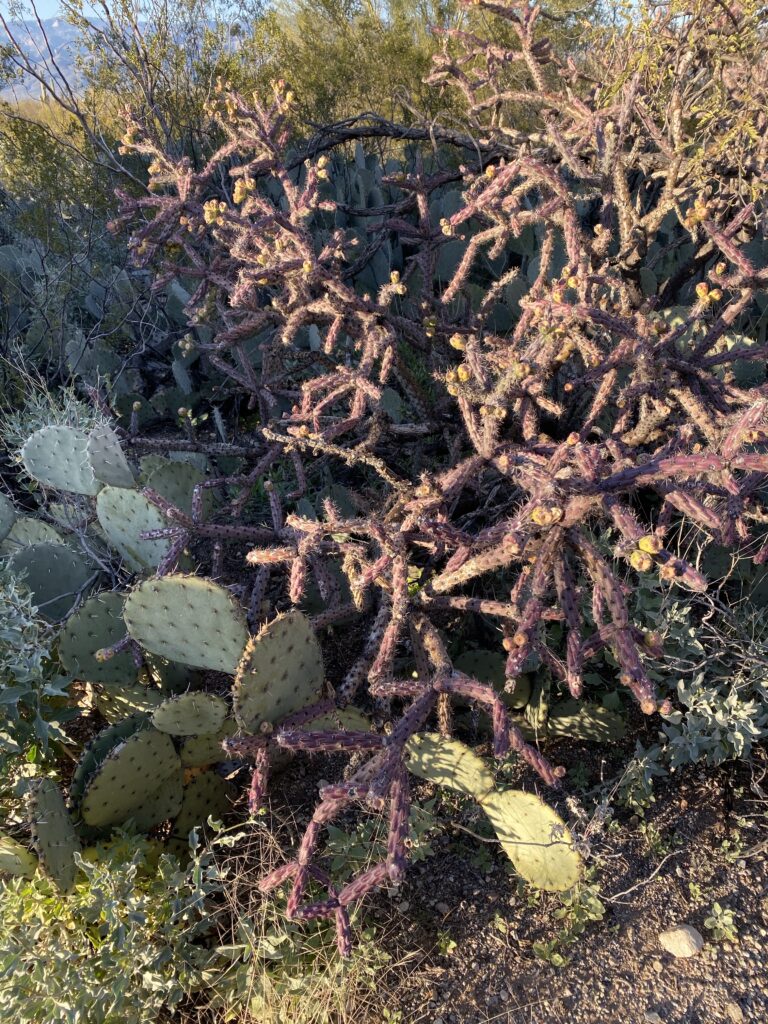
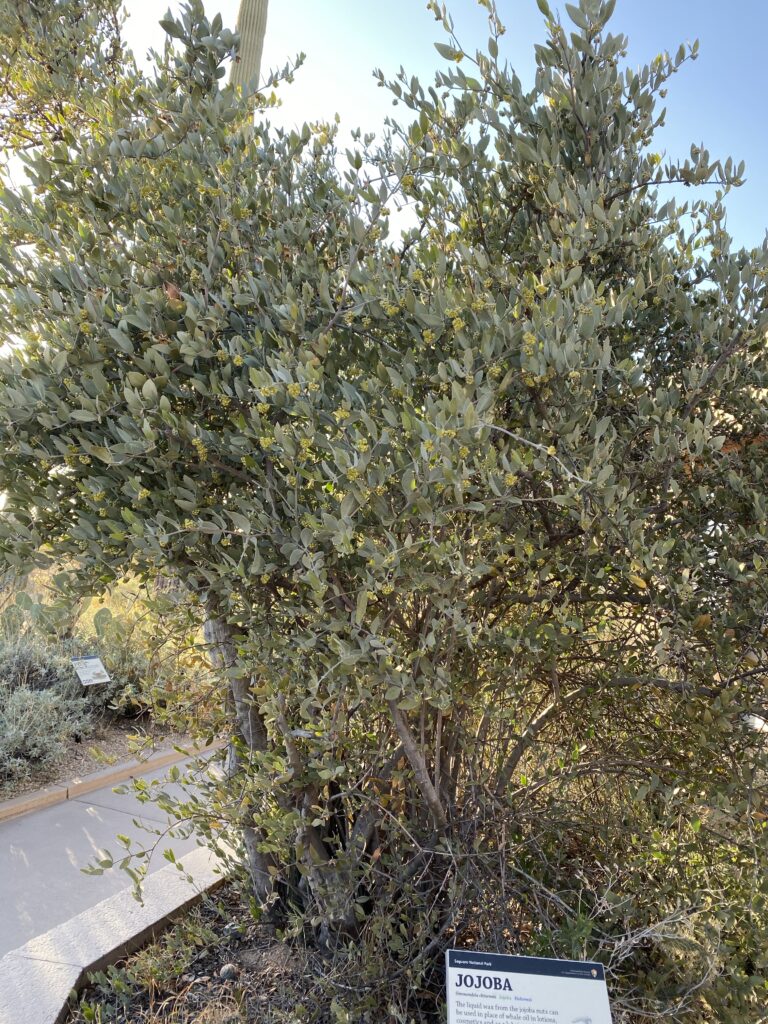
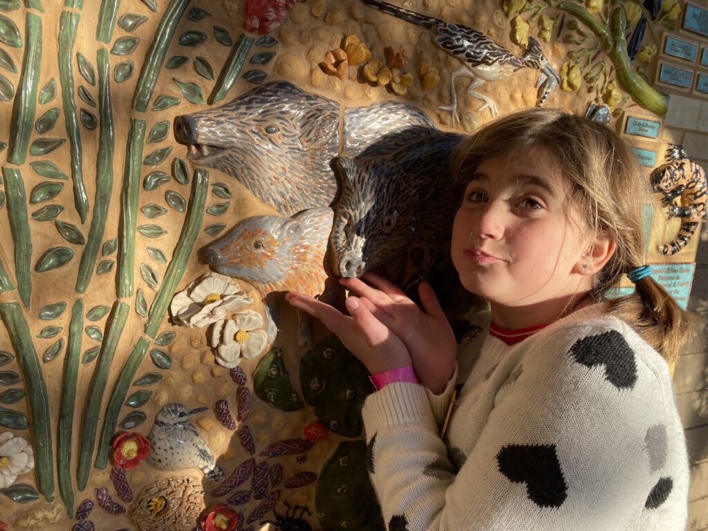
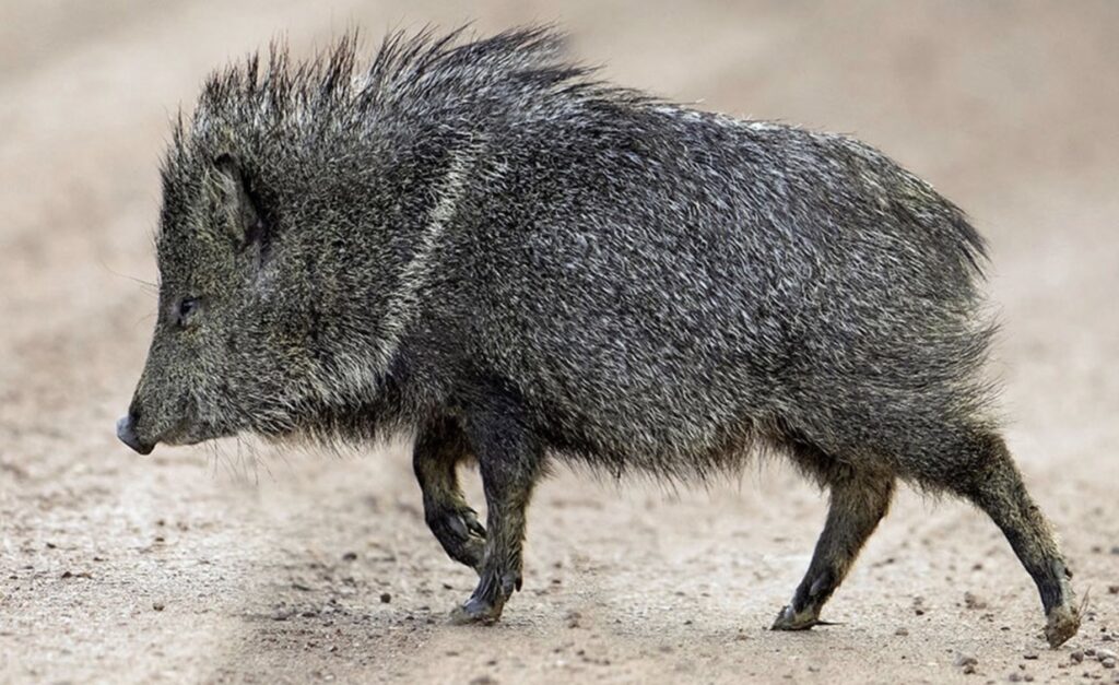
Cute little pineapple 🍍 fruiting cactusPrickly pearJojoba treeCute little “javelina”
The rest of the pics are ones we imagined we saw on our walk-about
the javelina we pretended to seeThe inside of the Saguaro 🌵 is also shelter to birds. Woodpeckers peck out the holes, other birds move in.
We didn’t go check out the camping spot Terry told us about because after the game, and laundry, it became crazy windy so we decided it was probably smartest/safest to stay in town.
Since we were still in town we decided to go back to the Glen Canyon Dam and look around and maybe learn some info about dams that we were unable to at Hoover.
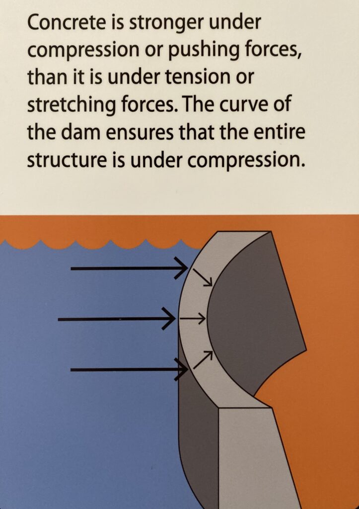
It worked out great because both Hoover Dam and Glen Canyon Dam are similarly constructed. Also, Glen Canyon Dam, which created Lake Powell, and dams the Colorado River upstream (East) of the Grand Canyon and Hoover Dam is downstream (west) of the Grand Canyon.
The bridge is a single arch steel bridge and had to be built first. It spans over Glen Canyon at 1,271’ long and lives 700’ above the river bottom.
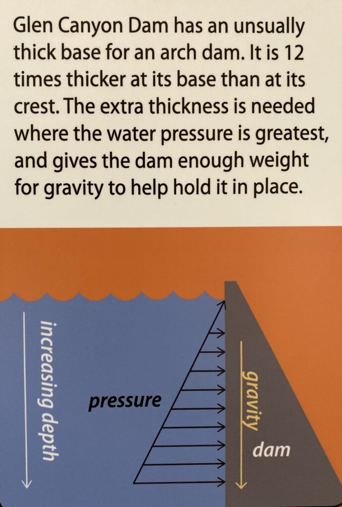
The dam itself is 710’ tall, 1560’ long, 25’ thick at the crest and 300’ thick at the base.
The reason for the difference in thickness from the top to the bottom of the dam is to deal with forces of the water pressure from the now dammed up lake, in this case Lake Powell.
Also, exciting we/I finally understand how dams work.
Water enters the intake tubes from the lake (on the left) and flows down the “penstock” (the long diagonal pipe that carries the water down the dam)
The gravitational force of the water turns the turbines (at the bottom of the dam) which in turn spins the rotor of the generator and creates energy. In effect…it’s turning potential energy (of the water in the reservoir) into kinetic energy (from the movement of the water) . This energy can be captured and stored as power, hydroelectric power (meaning water is the source of the power). The mechanical energy of the turning of turbines is transferred to electricity through the generators. After, water is released back into the river on the other side of the dam to co retinue flowing downstream.
There are 2 main reasons why dams are built. One, to create a reservoir and store water to help ensure water for both urban and rural areas during inconsistent rainfalls or drought years. Two, to create power, hydroelectric power.
Steps of dam building. 1. Build bridge 2. Divert river 3. Build Dam 4. Place generators 5. Fill up the reservoir. Lake Powell took 17 years to fill and was first filled on June 25, 1980.
3 necessary things when finding a proper dam site… 1. Large water storage area 2. Strong, safe , sturdy site (in this case the canyon walls) 3. Must be economically feasible.
Lake Powell was the lake created as a result of the Glen Canyon Dam. It is America’s 2nd largest resevoir (when full) behind Hoover Dam’s Lake Mead (largest resevoir when full).
What are the downsides of dams??? Well there are a few I’ll mention. 1. The sediment carried in rivers is not passed through the dam so now many polluted sediments/minerals (mainly from agriculture runoff) stay in the lake and are not passed through the river system allowing the pollution to get re-absorbed throughout nature. 2. The landscape is used to fluctuations within river flows and can help the health of the river and its banks. With a dam it is generally a consistent flow of water that is “let out” of the river on the downstream end. They are now trying to mimic these “flash floods” by allowing water to pass through the spillways and doing research to see the effects of this. Environmentalists like this and would like to see it continue. The other side argues it’s a loss of a lot of energy that could’ve been created. 3. The water that comes out of the dam is cold which has been proven to be harmful to the reproduction of many fish species. The dams also construct certain species from staying within the dammed up parts of the river.
Although in our day and age, dams also seem to be vital for us humans to have access to both water and power.
It started with the Colorado River Compact of 1922. It was agreement between 7 states in the Colorado River Basin governing the allocation of the “river rights”. It divides the river basin into 2 parts, upper and lower. The compact required the upper states to NOT deplete the flow of the river below 7,500,000 acre feet in a 10 year period (this was roughly half the water flow at the time). In addition 1,500,000 acre feet was promised to make it down to Mexico. This river compact led to the creation of Hoover Dam. However as water needs rose, the need for another dam to regulate the flow of the Colorado River was needed. Also the annual flow near Lee’s Ferry (beginning of Grand Canyon) was erratic and it prevented the upper states from delivering the water agreed to in dry years and oversupplied in wet years.
Okay, enough dam info for now…pun intended 🙂 But I do have to say that I thoroughly enjoy feeling that I finally understand the engineering, workings, and purpose, behind dams. The kids do now as well, well today they do.
We are heading now towards Petrified Forest National Park in Arizona. Edwin got in touch with an old co-worker from CDA who now lives in Payson, AZ which was only a little detour so we headed down there for the night.
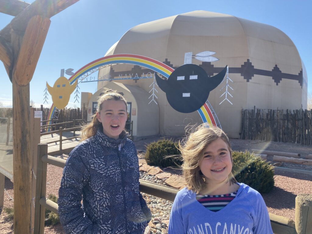
Another small detour driving down to Gordon & Donna’s was the Interactive Navajo museum. It was only 10 miles off the highway. No one was really in the mood to go, but we are in Navajo lands and felt it important to learn a bit about their culture. This is what the land looks like as we turned off.
Of course, after making the effort to go and it did sound neat, the museum was closed for renovations.
They had a few tablets outside.
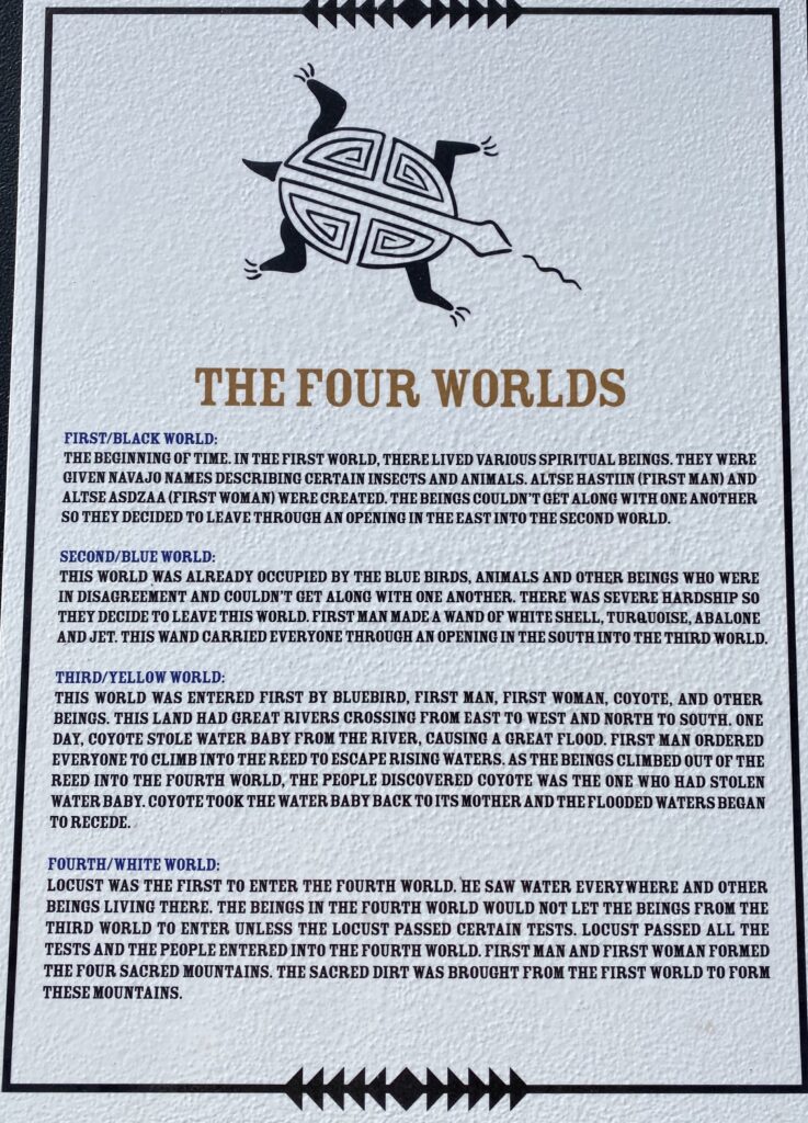
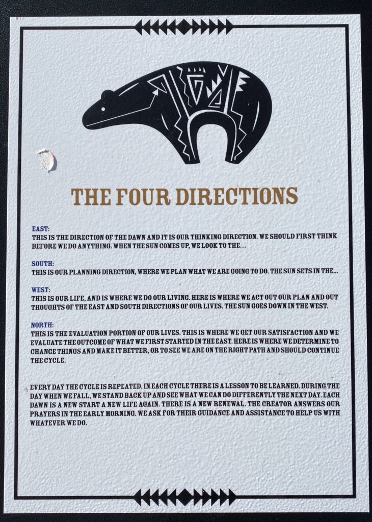
The Navajo people believe they passed through three worlds before arriving in this world, the Fourth World or the Glittering World.
The Navajo believe in 2 classes of people, Earth People and Holy People. As Earth People, they must do everything within their power to maintain the balance between Mother Earth and man.
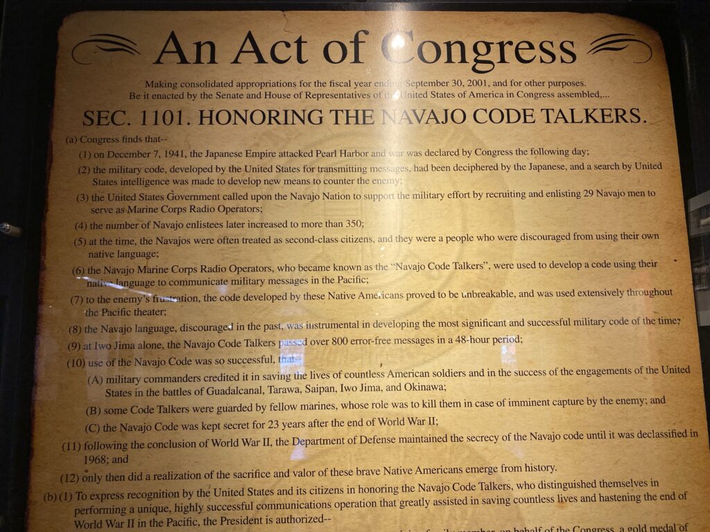
The museum was closed but next door at the tracing post there was another small museum dedicated to the Navajo code talkers of WWII. At a time when speaking your native tongue was demonized the Navajo were enlisted by the government as the code talkers during WWII after the currently used code was deciphered. They were instrumental for victory at Iwo Jima, sending over 800 error free messages in a 48 hour period. Their code was never broken and was kept secret for 23 years after the war. It was also used I. The Korean and Vietnam wars. The Navajo code is the only spoken military code never to have been deciphered. The last living Navajo code talker just died a few days ago, Joe Vandever Sr. died at 96 on January 31, 2020
So that is pretty neat. I’d heard about them before, but that 15 min was worth the 25 min detour.
I drove the rest of the way to Payson and it was nice to see a familiar face from a fun time period. Thanks for having us Donna & Gordon.