Morning time.


We biked for a whole 2 minutes to the visitor center because we didn’t realize the visitor center was connected to the campground.

We were at the visitor center and learned a little bit about Death Valley National Park.

Death Valley only became a national park in 1994, but is the largest national park by square miles in the lower 48 (one in Alaska is larger.)
It is also the hottest, driest, and lowest of all the national parks. It holds the record for highest temperature on Earth at a recorded 134 degrees in the shade. It rains less than 2” a year (desert means it get less than 10” a year)

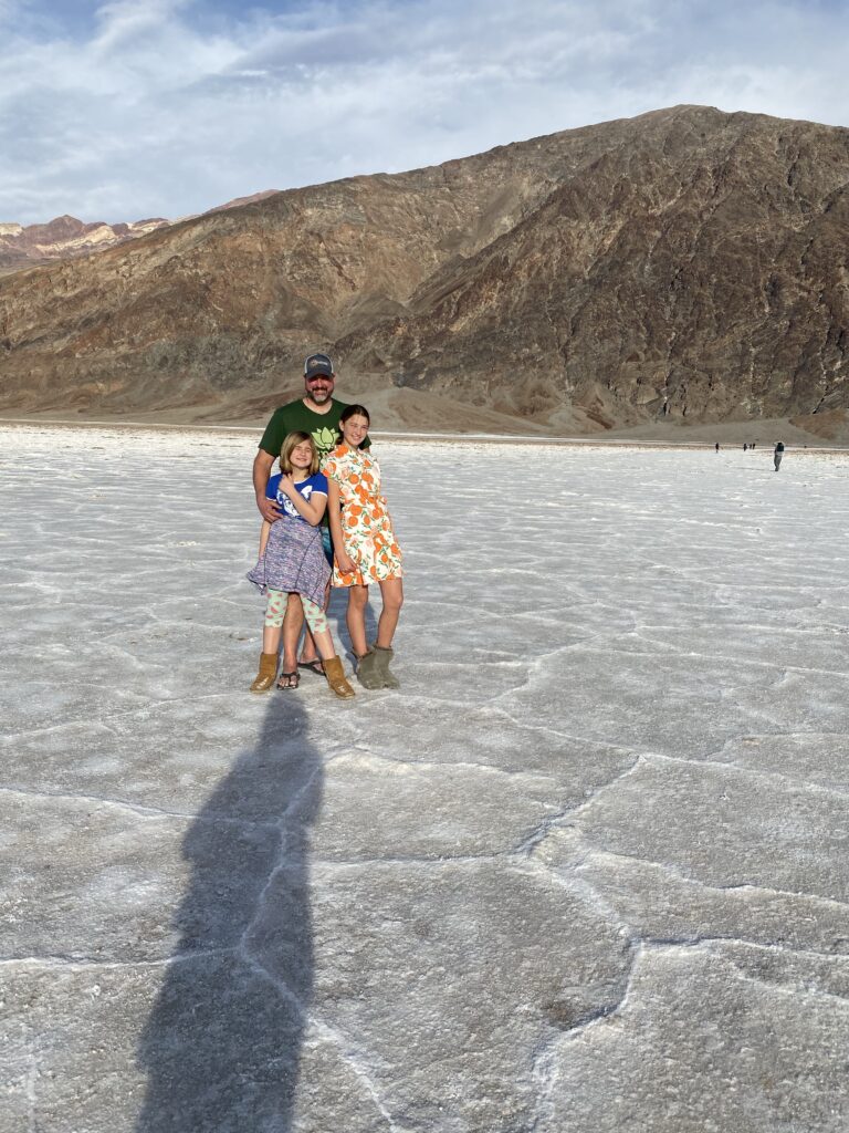
Badwater Basin at -286 feet below sea level and is the lowest place on the entire continent.
There are 2 major valleys in Death Valley National Park, Death Valley and Panamint Valley.
There are 3 major mountain ranges to the West of Death Valley National Park, Sierra Nevada, Argus, and the Panamint range, lies directly to the west. The Black range is directly to the east.
Death Valley National Park was NOT formed by river erosion. It is part of the “basin and range” formation like Great Basin National Park in Nevada. The earth went through a period of expansion and uplift. There are vertical fault lines in the continental plates and the large blocks of land in between the faults would tilt up on one end and down the other similar to a seesaw. Badwater Basin is the “bottom of the seesaw” and the Panamint mountains to the west are the “upslope of the seesaw” of the same block of land between the faults. The Black Range directly to the East are the “upside of the seesaw”, the beginning of another fault block. These geological forces continue today and during an earthquake Death Valley continue today and Badwater Basin can and most likely will continue to drop in elevation during the next earthquake.


Mountain “ranges” are formed. The “in the beginning valleys” collect sediment from the surrounding mountains and “fill up” and “flatten” the valleys into “basins”. Hence…Basin & Range.
The towering Panamint range of over 11,000 peaks are a stark contrast to the lowest point of Badwater Basin directly at its base. The tallest mountain in N. America, Mount Whitney lies not far from here at the edge of Sequoia National Park and is an example of the greatest topographic change in a short area.
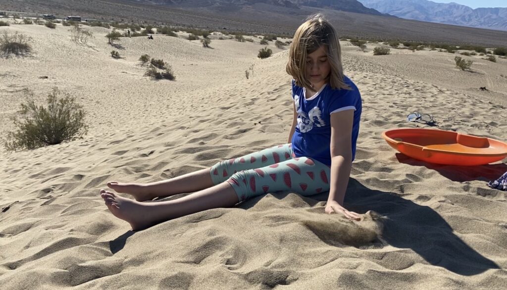
We went to the sand dunes first. We brought our saucers from Tahoe but they weren’t working. I remember renting saucers at white sands national monument years ago and it was super fun. Nobody was in the mood to walk out to the further steeper talker dunes to test it out more. So we we were satisfied snowboarding on them, rolling down the hill, and having a little rest in the sunshine.


Badwater Basin s the lowest point in North America at 282’ below sea level. It is among the largest salt flats in the world stretching over 40 miles. There are 3 things needed for a salt plain. 1. A basin 2. High evaporation rate 3. Source of salt.
To have land below sea level an extremely dry environment is necessary. In wet climates water collects in the lowest areas and flows out to the sea. A dry climate evaporates the water leaving behind salt flats. Sea level is the average elevation of the worlds ocean surface and is the standard from which all elevations are measured. Regardless of tides, sea level remains the same. (Fun fact: the Caribbean is higher in elevation than the Pacific)


Edwin was a good sport and was the large Panamint mountain range.


Death Valley National Park has very clear examples of an “alluvial fan”. “An alluvial fan is a triangle-shaped deposit of gravel, sand, and even smaller pieces of sediment, such as silt.”


We stopped by the “devils golf course” on the way back to camp and we hung out at camp. No one was up for any big walks today. The girls did junior ranger books, rode bikes, Edwin and I made dinner, and we had a fire and watched the stars. It is a great night sky here and the moon is a small crescent.

